Case Studies
What the work looks like, on real wildfires.
Every map on this page was delivered on a real wildfire. First the 2026 season: nine fires, night by night, through the sheets state and private flying teams delivered through the Collaborative's system. Then six fires from 2024 and 2025, each written up from its own map sheet.
How a map is made
From a thermal mosaic to a map a crew can use, layer by layer
One night's flight over the Interstate 5 fire, milepost 57: the stitched thermal mosaic first, then each layer of the delivered map set, in the symbols every sheet uses.
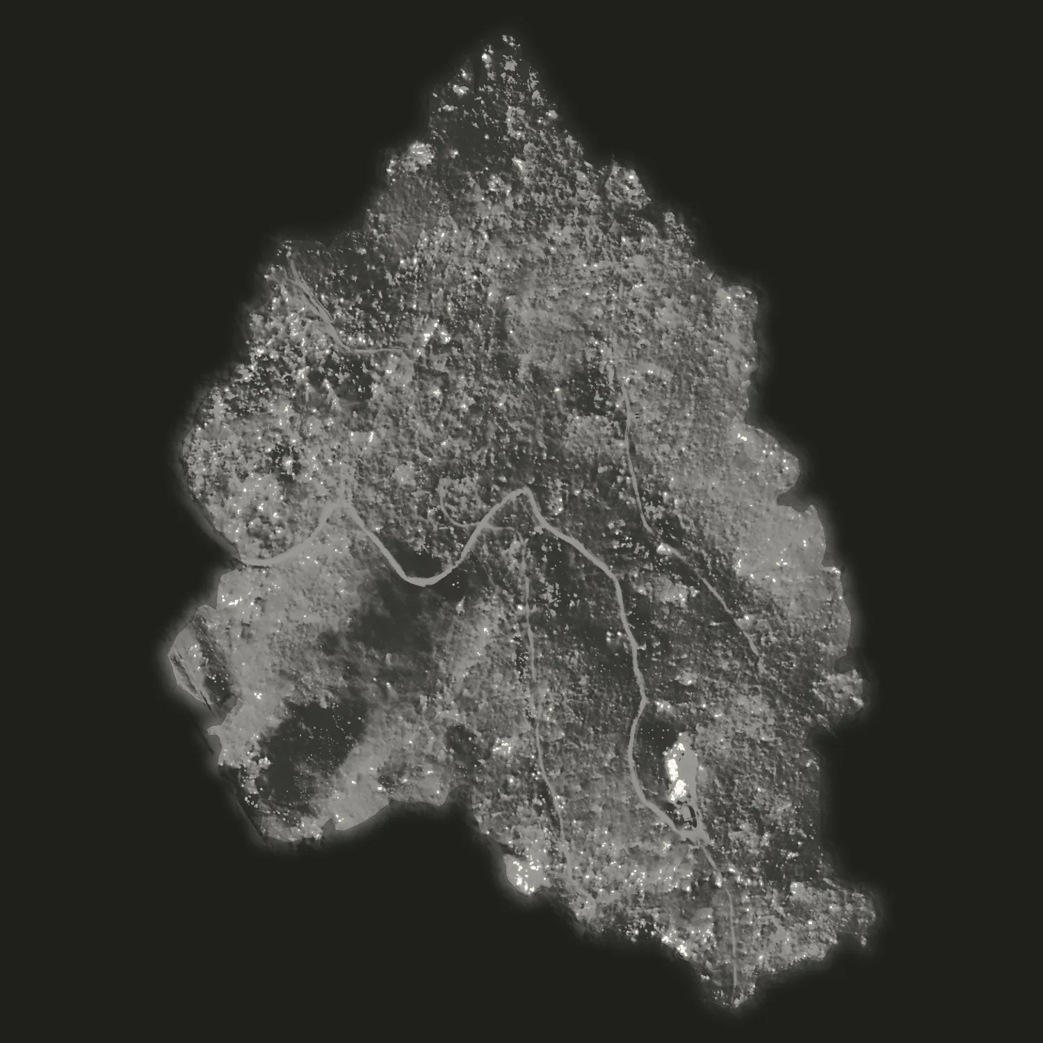
- The thermal mosaic Hundreds of thermal frames from one night's flight, stitched into one thermal image of the ground. The whiter the ground, the warmer it reads.
- IR heat perimeter The outer edge of the heat, as the pilot mapped it, drawn in pink because a drone flew it.
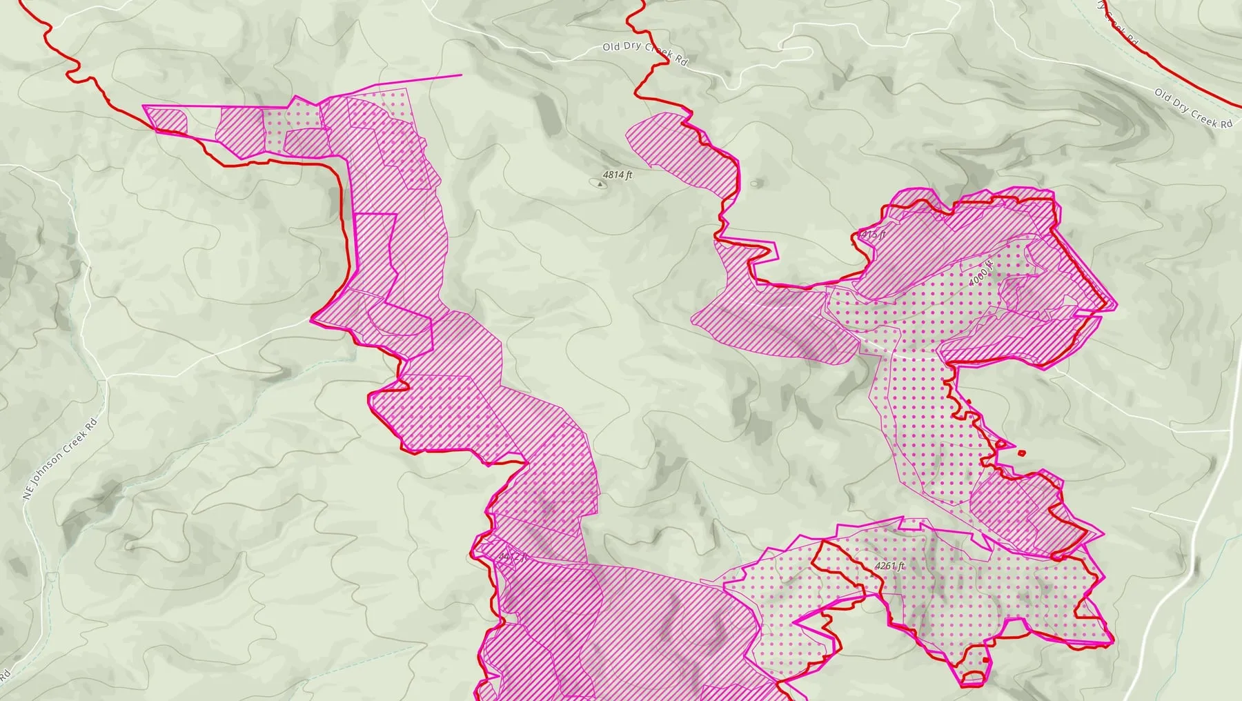
- Intense and scattered heat Hatched where the heat is continuous. Dotted where many small heat sources sit close together.
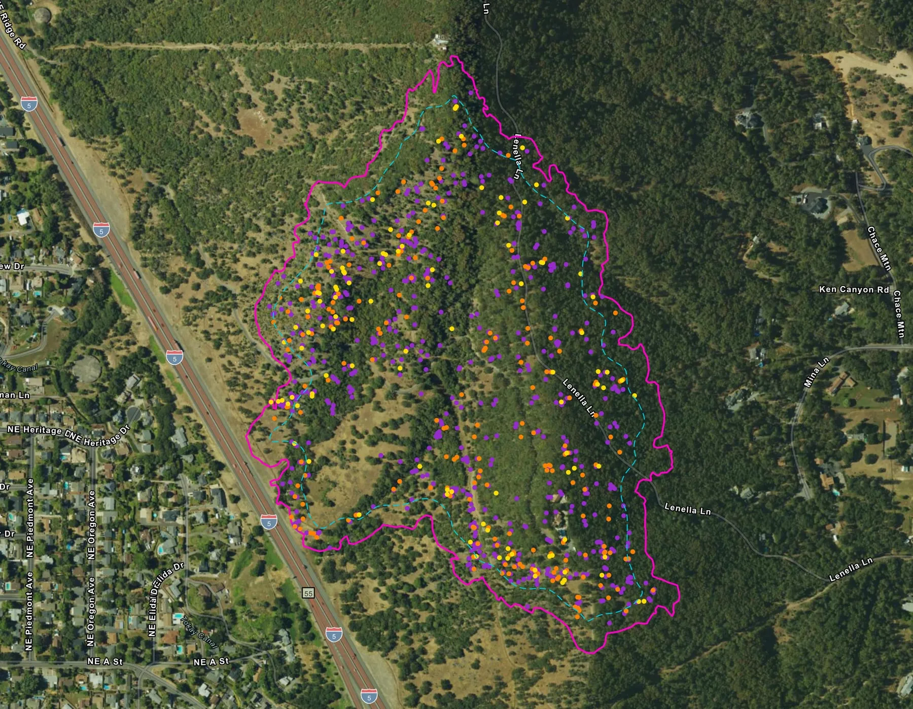
- 143 isolated heat sources Each single heat source outside those areas, a pink dot with a black ring. Each is a place a crew can walk to.
- Mop up buffer A dashed line a set distance in from the heat perimeter, so a crew can see which heat sits close to the edge.
-
Pink is a drone. Red came from elsewhere: a crewed aircraft's map or the incident's daily fire perimeter. Every map the Collaborative makes follows that rule, so anyone on the fire can see at a glance what the drone found.
2026 case studies
Nine fires, night by night.
Each follows one fire through the sheets its incident received, the notes its pilots wrote on the record, and every approved map set.
-
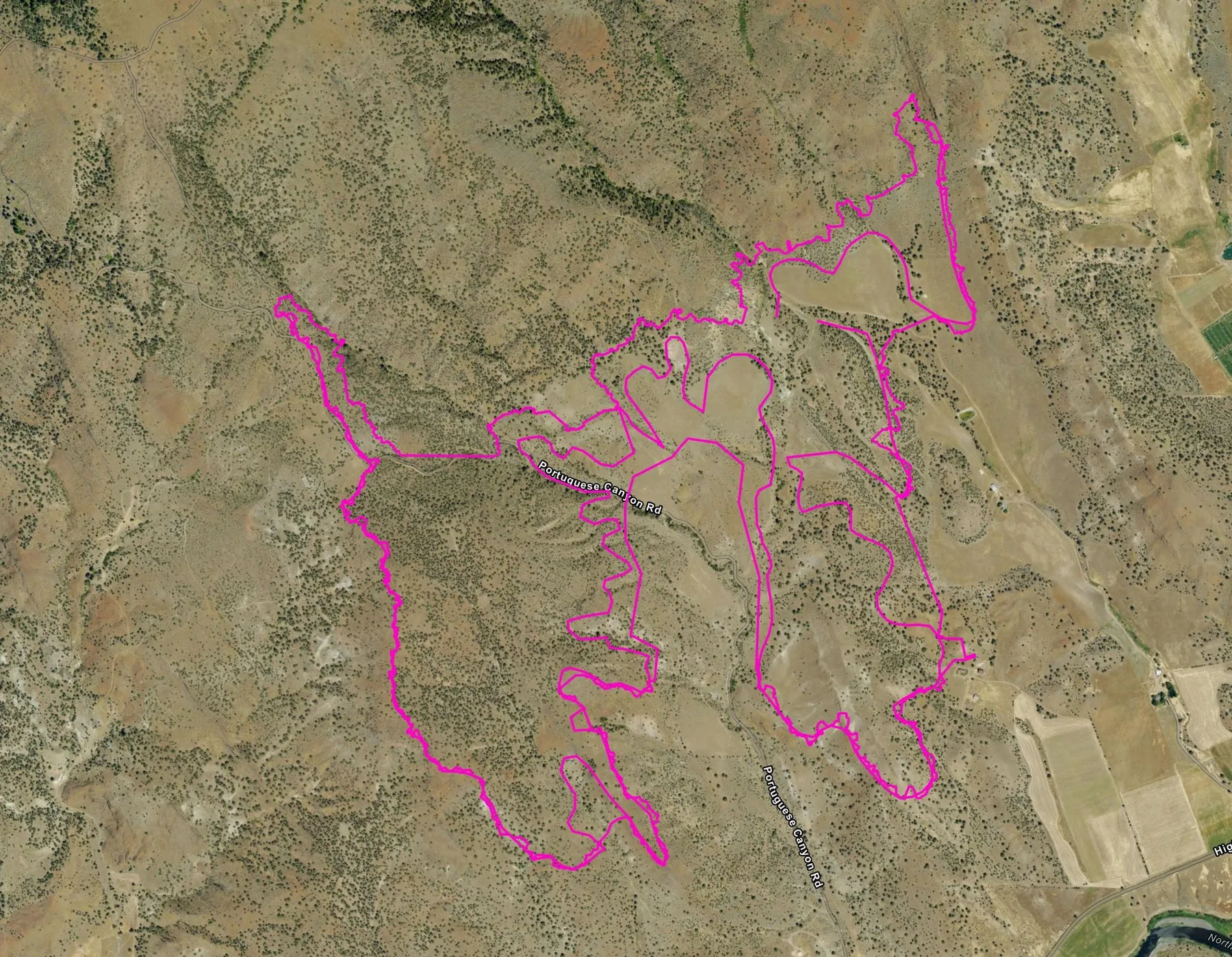
Bologna
A pink heat perimeter from a state drone, then a week of flights along the line as the heat near it faded.
- Hummingbird Drones
- Oregon Department of Forestry
- Nights
- 8
- Map sets
- 12
- Acres on record
- 4,436
-
East Evans Creek
The fire where the 2026 season's first automated map sets were made, mapped division by division for three weeks by two organizations.
- Rogue Reconnaissance, the founder's company
- Oregon Department of Forestry, South Cascade District
- Nights
- 15
- Map sets
- 37
- Acres on record
- 15,580
-
Brewer
Drone heat along the daily fire perimeter, heat mapped outside it for spot fires, and a crewed aircraft's own flights turned into the same map set.
- Hummingbird Drones
- Oregon Department of Forestry
- Nights
- 6
- Map sets
- 8
- Acres on record
- 70,821
-
Rowe Creek Complex
The largest fire in the archive this season, flown along the line by three organizations and two kinds of drone, from late July to the end of August.
- Hummingbird Drones
- Oregon Department of Forestry
- Oregon Department of Forestry, South Cascade District
- Nights
- 19
- Map sets
- 48
- Acres on record
- 373,927
-
Interstate 5 at milepost 57
A first perimeter on initial attack beside the freeway, then two flights a night for the crews mopping it up.
- Rogue Reconnaissance, the founder's company
- Nights
- 5
- Map sets
- 10
- Acres on record
- 100
-
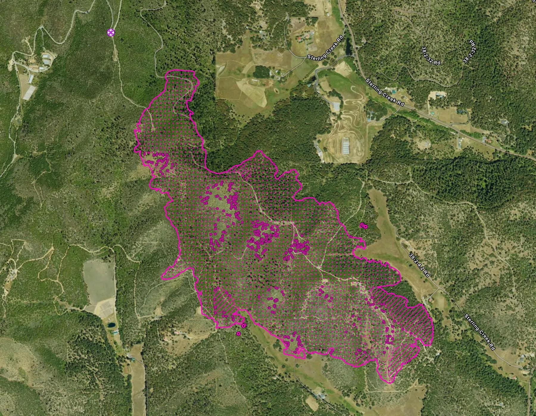
Woodrat Mountain
A fast perimeter the night it was reported, a return eight nights later, and a last look that found almost nothing, until the pilot walked it.
- Rogue Reconnaissance, the founder's company
- Nights
- 3
- Map sets
- 4
- Acres on record
- 282
-
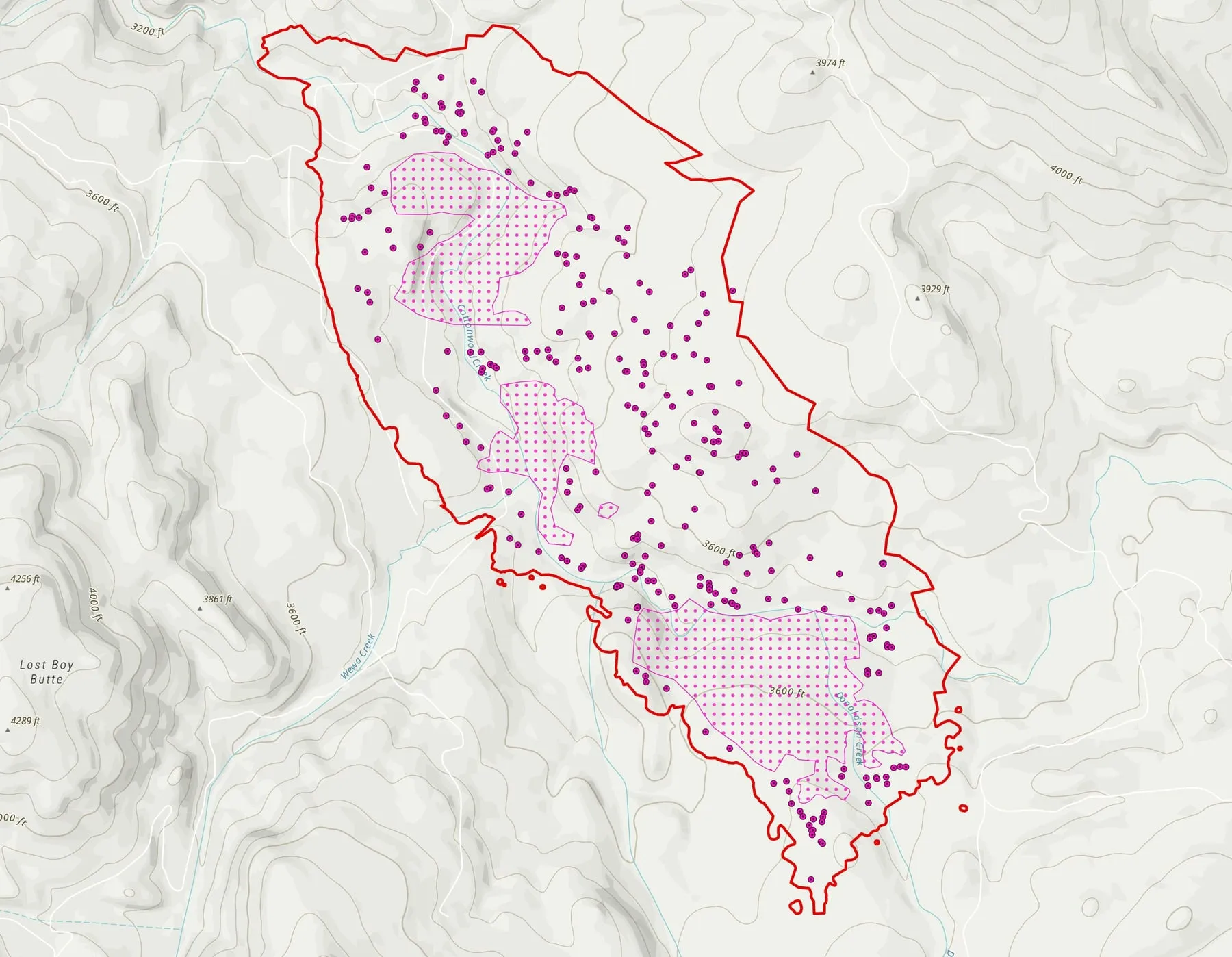
Cottonwood
Two organizations, five nights apart, and two ways of drawing heat on the same fire, point by point and as areas.
- Hummingbird Drones
- Oregon Department of Forestry
- Nights
- 2
- Map sets
- 2
- Acres on record
- 722
-
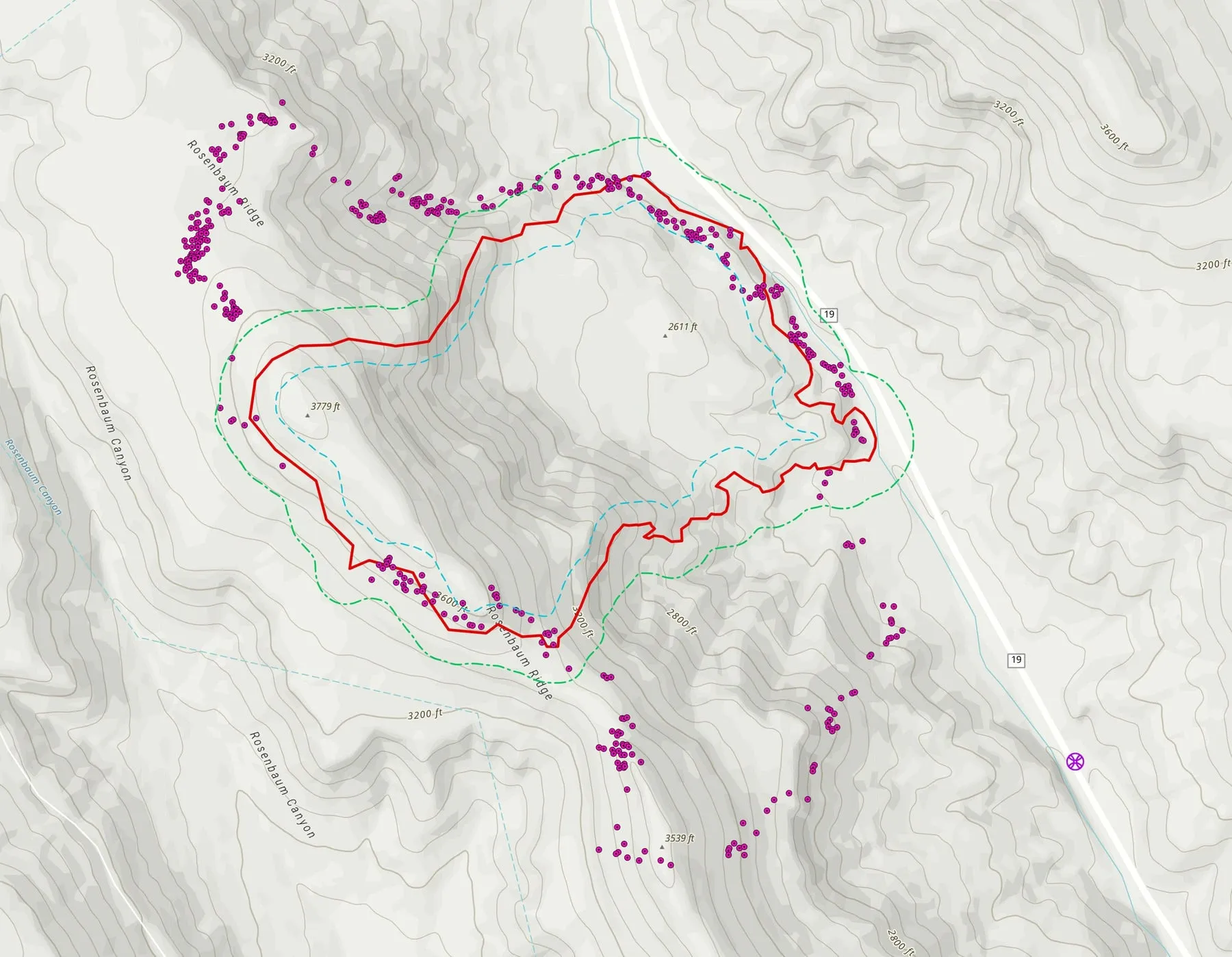
Rosenbaum
Mapped the night it was reported, then scanned before dawn three mornings running, with the heat that sat beyond the daily fire perimeter on the map.
- Hummingbird Drones
- Oregon Department of Forestry
- Nights
- 7
- Map sets
- 9
- Acres on record
- 483
-
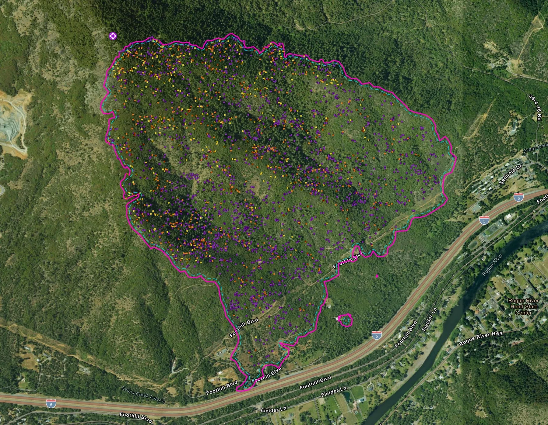
Fielder Mountain
Night after night over the same steep ground, and what happened to the heat inside a perimeter that never moved.
- Rogue Reconnaissance, the founder's company
- Nights
- 11
- Map sets
- 13
- Acres on record
- 573
Reading the map
Pink is a drone.
Red came from elsewhere.
In 2026 the Collaborative set one color rule with the Oregon Department of Forestry's GIS staff, and every map the system makes follows it. Everything the drone mapped is drawn in pink. Red is what came from somewhere else: a crewed infrared aircraft's map, or the incident's own daily fire perimeter when a drone map carries it. A firefighter or manager who glances at a sheet can tell what the drone found before reading a word, on any fire, from any pilot.
-
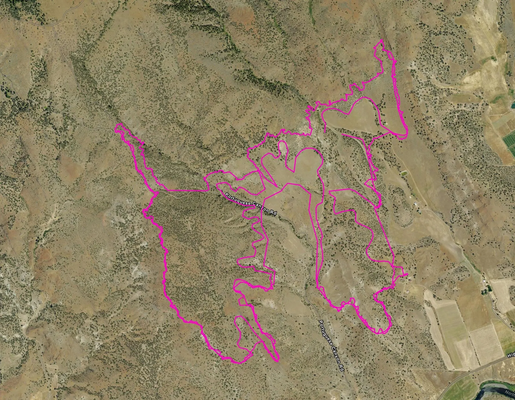 All pink A drone flew it Bologna, the morning of August 10. An Oregon Department of Forestry drone mapped the heat perimeter on the south end of the fire.
-
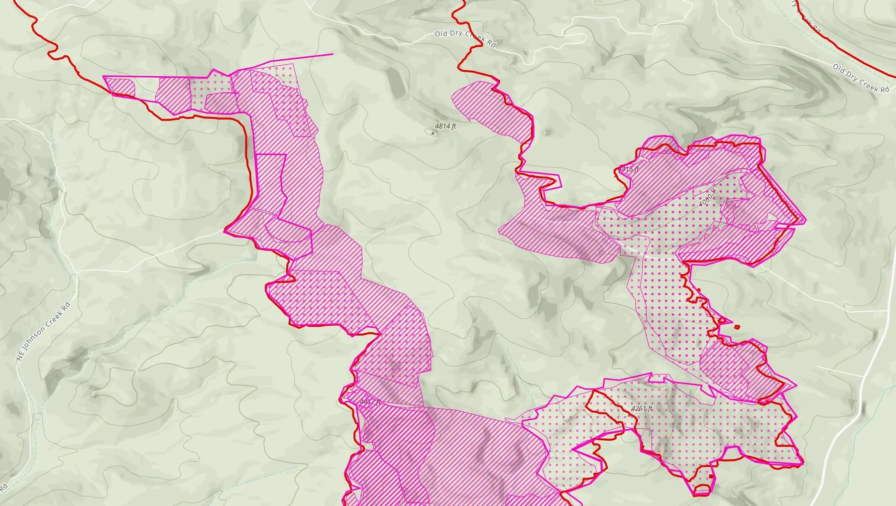 Pink on red A drone map on the daily fire perimeter Rowe Creek Complex, West zone, July 30. Hummingbird Drones' intense and scattered heat along the incident's daily fire perimeter.
-
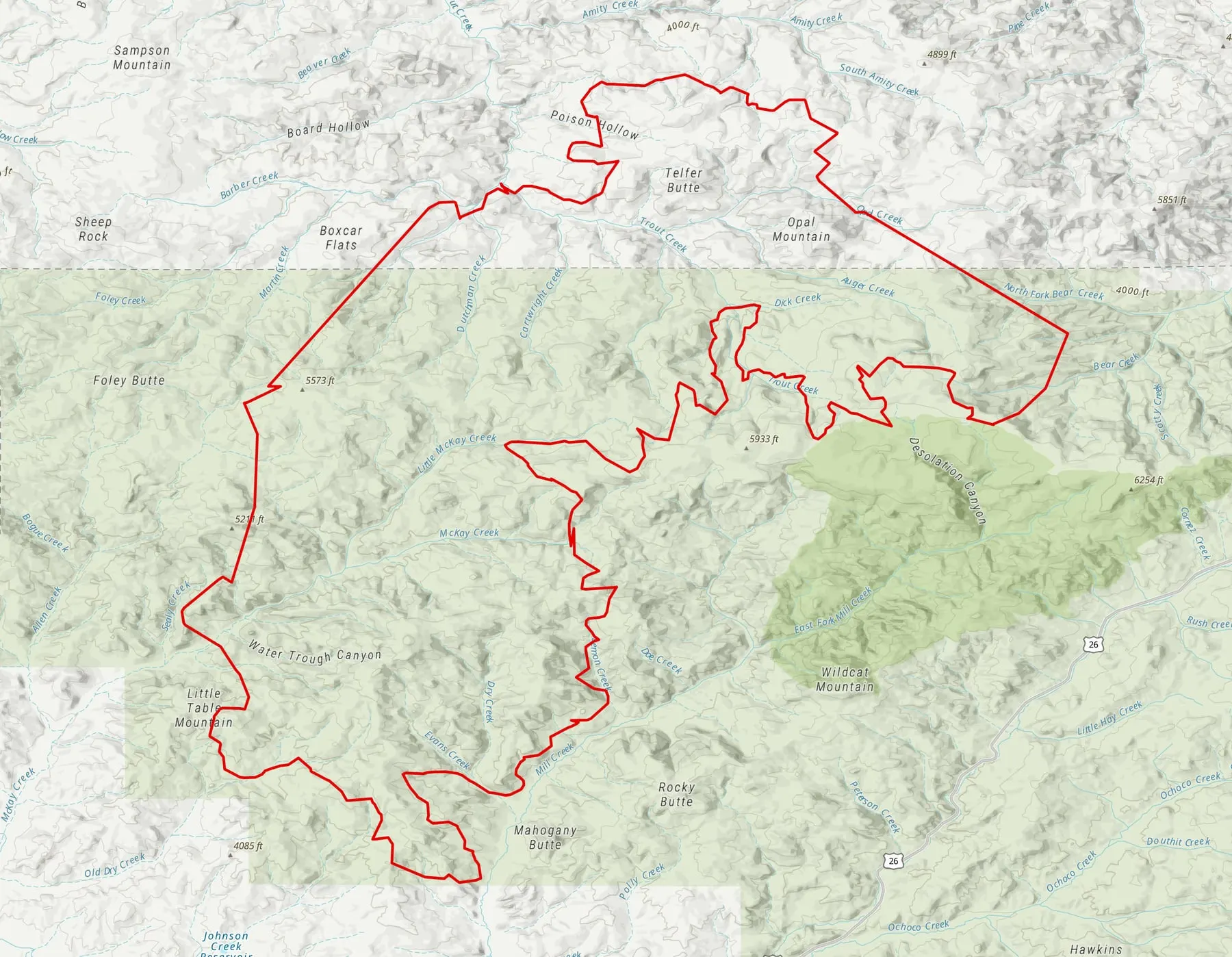 All red A crewed aircraft flew it Brewer, July 29. The Oregon Department of Forestry's crewed infrared flight, turned into the same map set.
Every symbol on the sheets
Drawn in pink: a drone flew it
- IR heat perimeter
- The outer edge of the heat on that flight, as the pilot mapped it from the drone's imagery. It is the drone's reading of the heat, not the incident's fire perimeter.
- IR intense heat
- An area of continuous, active heat, hatched.
- IR scattered heat
- An area of many separate heat sources close together, dotted.
- IR isolated heat source
- A single source of heat, too small or too far from others to draw as an area: a pink dot with a black ring.
- Possible heat source
- A heat signature the pilot could not confirm as fire, marked with a diamond. It tells a crew where to look, not what they will find.
- Spot fire
- A new fire outside the main perimeter, marked with a larger symbol.
Drawn in red: a crewed aircraft, or the incident's perimeter
- Crewed perimeter
- The heat perimeter from a crewed infrared aircraft's flight, turned into the same map set a drone flight gets.
- Daily fire perimeter
- The incident's own interagency perimeter, mapped from infrared, GPS and hand drawn line work together. A drone map carries it beside its own pink heat, so a crew sees the drone's heat against the perimeter the incident is using. Sheets made before August 20, 2026 label it Crewed Perimeter.
Also on the sheets
- Graded heat
- Some sheets grade each isolated heat source high, medium or low, in yellow, orange and purple. The grade comes from the pilot's processing software, and on the graded sheets on this site it is set against the rest of that flight, so a grade is not a temperature and does not compare from one night to the next.
- Mop up buffer
- A dashed line a set distance in from the perimeter, measured along the ground, so a crew can see which heat falls inside the depth it is mopping up.
- Outside buffer
- A line a set distance outside the perimeter, marking the band a crew checks for spot fires.
- Area covered by the flight
- The ground the aircraft actually scanned. Outside it, an empty map means nobody looked, not that nothing is there.
- Launch and recovery
- Where the crew launched and landed the aircraft.
Every sheet uses the same layout, colors and symbols. That is the point of standardizing: a reader who has learned one sheet can read all of them. The rest of the map set that comes with each sheet is on What we deliver.
2026 season
146 map sets, every one on the record.
2026 is the Collaborative's first fire season as a nonprofit, with the automated pipeline and the pilot portal in production. A pilot uploads a flight's heat layers and the pipeline returns the standard map set. Once the pilot approves it, the data goes live on the layers the incident's teams read. The finished map sets are also published to the public archive, uaswfc.org/ftp, filed in the folder tree and under the filenames the interagency share already uses.
The fires below were flown through the system by the Oregon Department of Forestry and its South Cascade District, by Hummingbird Drones, and by Rogue Reconnaissance, the founder's own company.
Every night of maps, fire by fire
One mark per night a map set was delivered, colored by the organization that flew it. An outlined mark is a crewed flight.
- Rogue Reconnaissance (the founder's company)
- Hummingbird Drones
- Oregon Department of Forestry
- Oregon Department of Forestry, South Cascade District
- Crewed flight
Nights counted September 13, 2026 from the submission records and the public archive. The number at the right of each row is its nights of maps. A flight after midnight counts with the night before it.
146 map sets, by who flew them
Map sets each flying team delivered through the system in 2026, and the aircraft it flew.
From upload to approved maps
Minutes from a pilot's upload to the pilot approving the finished map set, across the 137 sets where both times are on the record. The median is 18 minutes; 80 sets were approved within half an hour.
The time includes the pilot's own review of the maps before approving them, which is often the longest part.
How the season went
- May 21 The pilot portal goes live in production.
- July 22 First fire processed end to end by the automated pipeline: East Evans Creek, Division Y.
- July 23 First fire delivered through the pipeline by a pilot from an Oregon Department of Forestry district, on that district's own map template.
- August 19 A live video feed from the aircraft that an incident commander opens with no account.
- August 23 The public data page opens with no sign in, for agency GIS shops and incident commanders.
- August 28 The public archive goes up, with the finished map sets at public addresses.
Fires in the archive
11 fires, 79 nights of maps, 876 files in the archive
- Bologna 8 nights July 18 to August 18
- East Evans Creek 15 nights July 21 to August 9
- Brewer 6 nights July 24 to August 1
- Rowe Creek Complex 19 nights July 28 to August 30
- Interstate 5 at milepost 57 5 nights August 1 to August 5
- Eggo (archive) 1 night August 6
- Woodrat Mountain 3 nights August 6 to August 19
- Cottonwood 2 nights August 8 to August 13
- Rosenbaum 7 nights August 13 to August 22
- Little Bear (archive) 2 nights August 14 to August 15
- Fielder Mountain 11 nights August 15 to August 26
Counted September 13, 2026 from the submission records and the archive. The records hold 79 nights and the public archive 76: on three nights the approved map sets have no files in the archive. A flight after midnight counts with the night before it. The archive files each night under the next day's date, the operational period its maps served, the convention the interagency share uses.
2024 and 2025
The work the Collaborative was built on.
The practice is older than the nonprofit. These sheets were flown and produced in 2024 and 2025 under Rogue Reconnaissance, the founder's own company, whose name is on each one. The Collaborative was incorporated in May 2026 to bring this work to every pilot and agency that wants it, and the archive of that earlier work came with it.
-
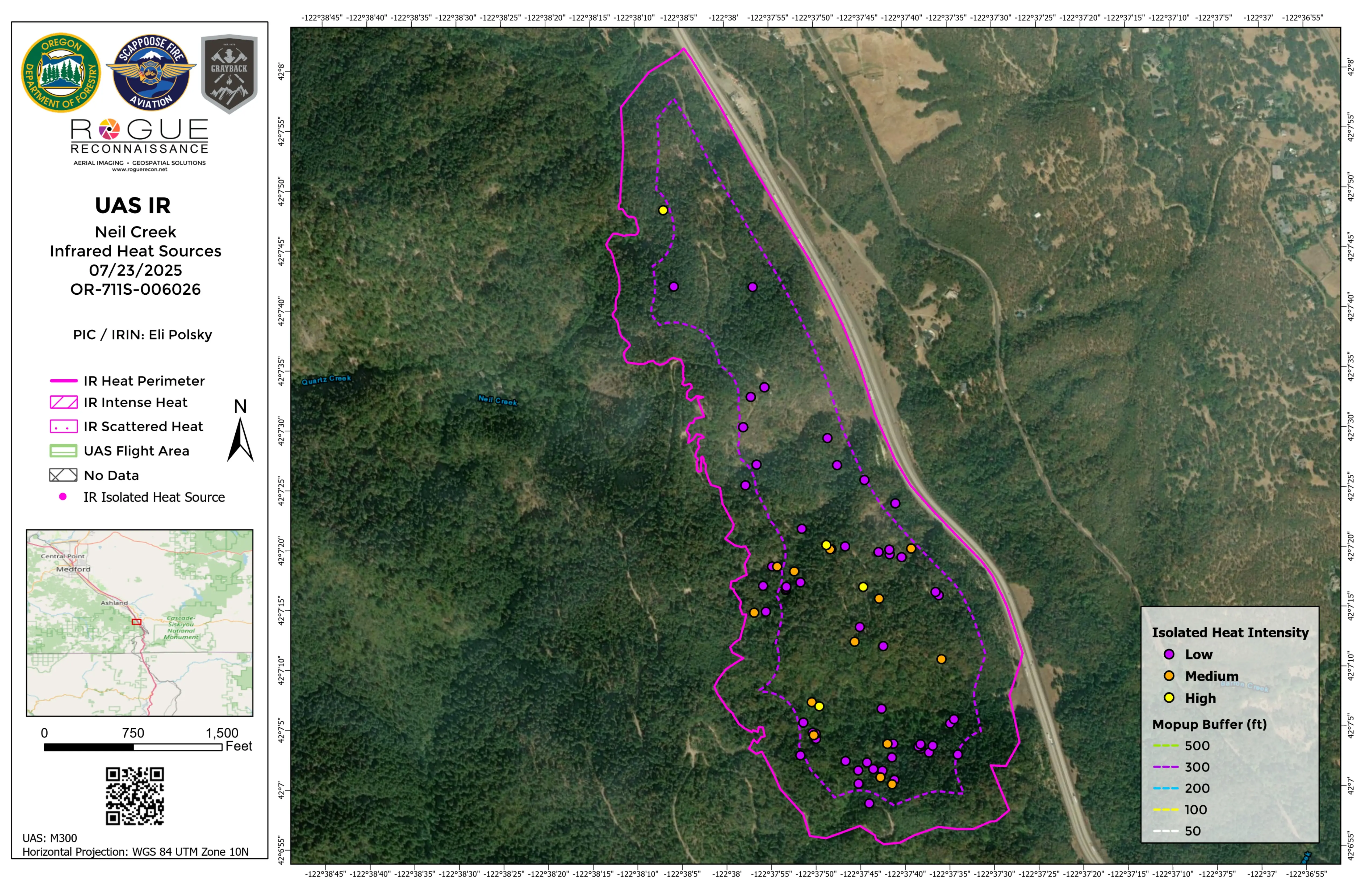
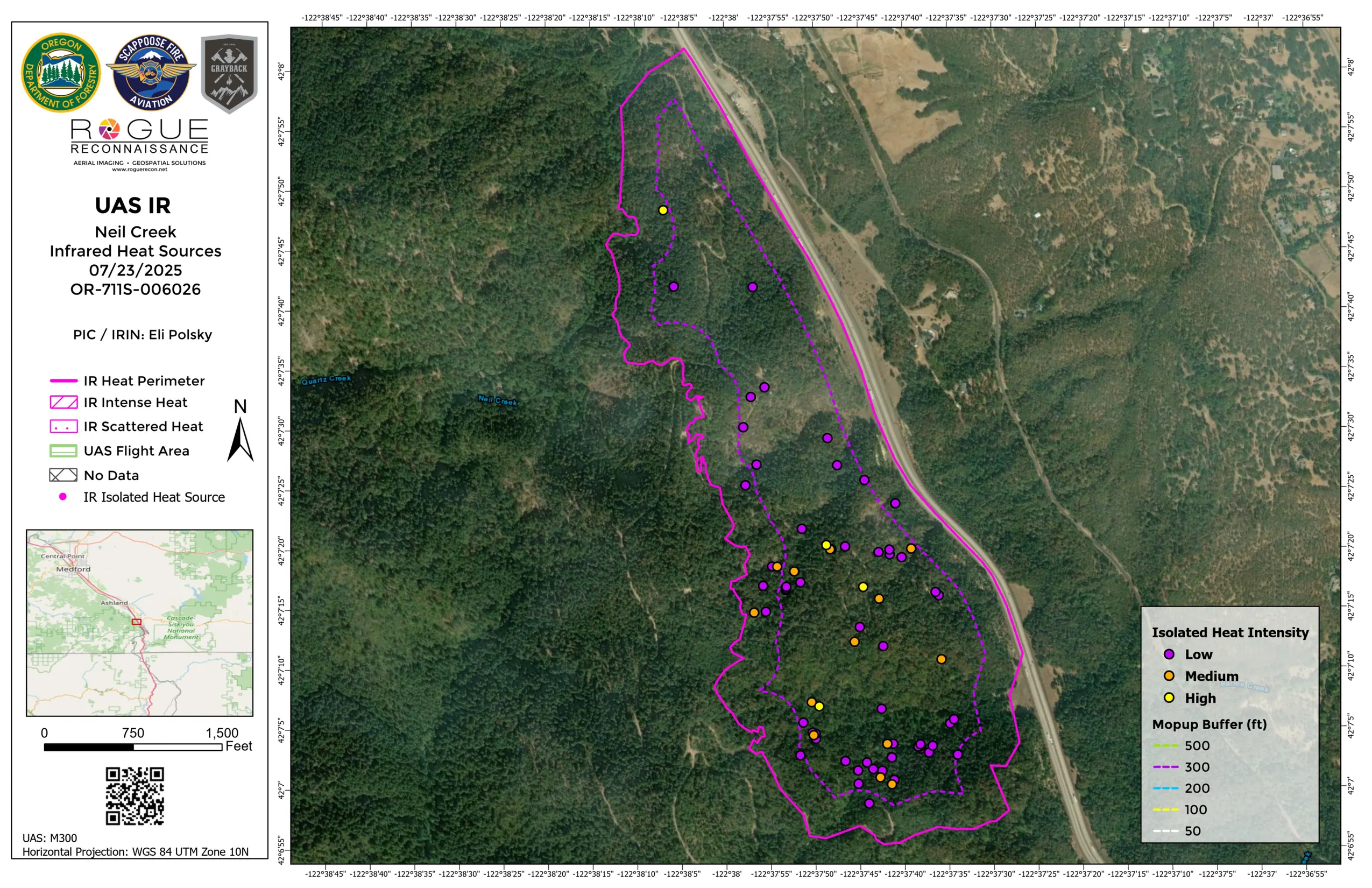
Neil Creek Grizzly Complex
A long, narrow perimeter in timber beside a road corridor.
More about this sheet
- Incident
- OR-711S-006026
- Aircraft
- DJI M300
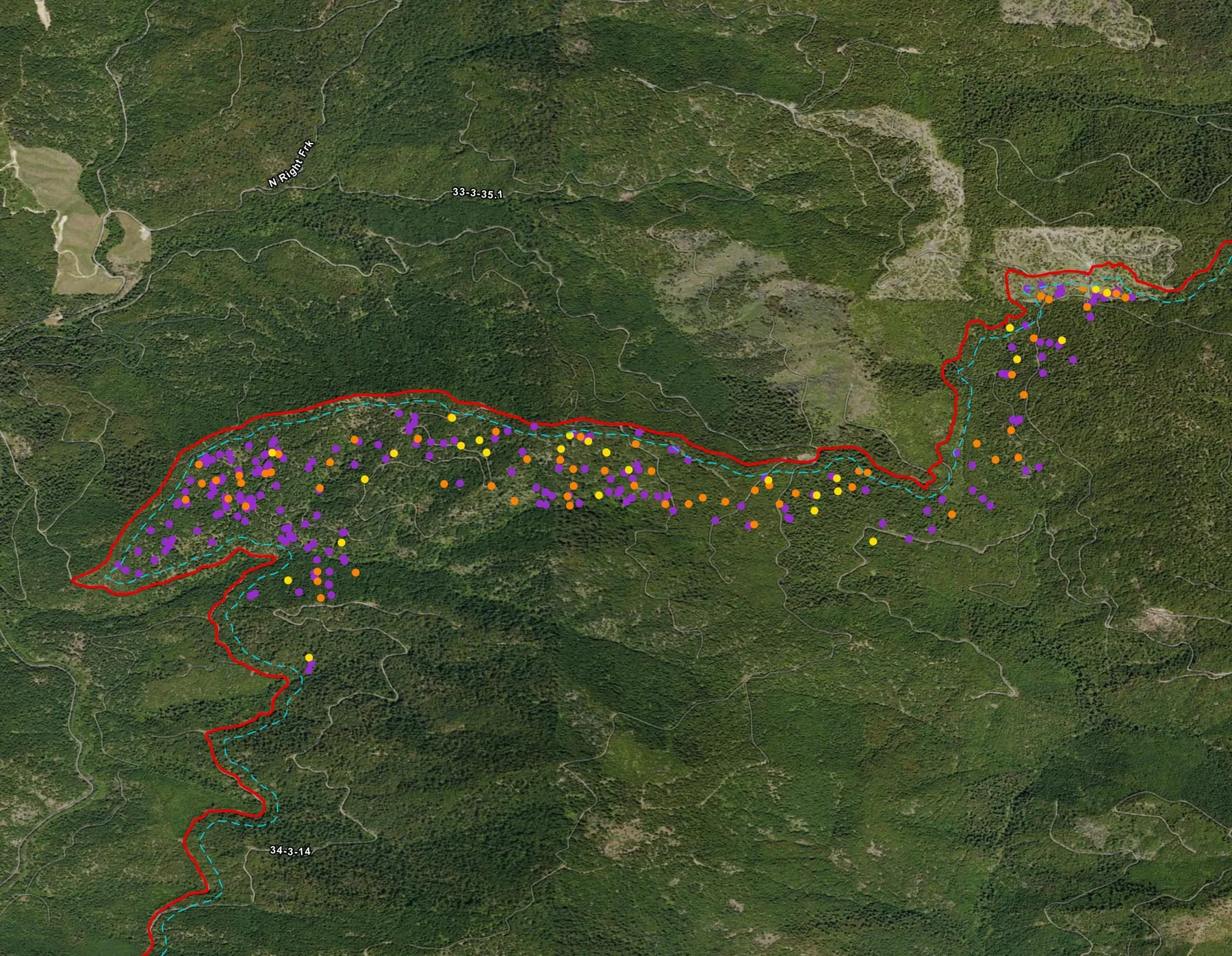
Every isolated heat source inside it is graded low, medium or high, and most of them sit in the southern half.
A 300 foot mop up buffer runs inside the heat perimeter. It separates the heat close to the edge from the heat deeper inside.
- Neil Creek, July 23, 2025. Open the full sheet ›
-
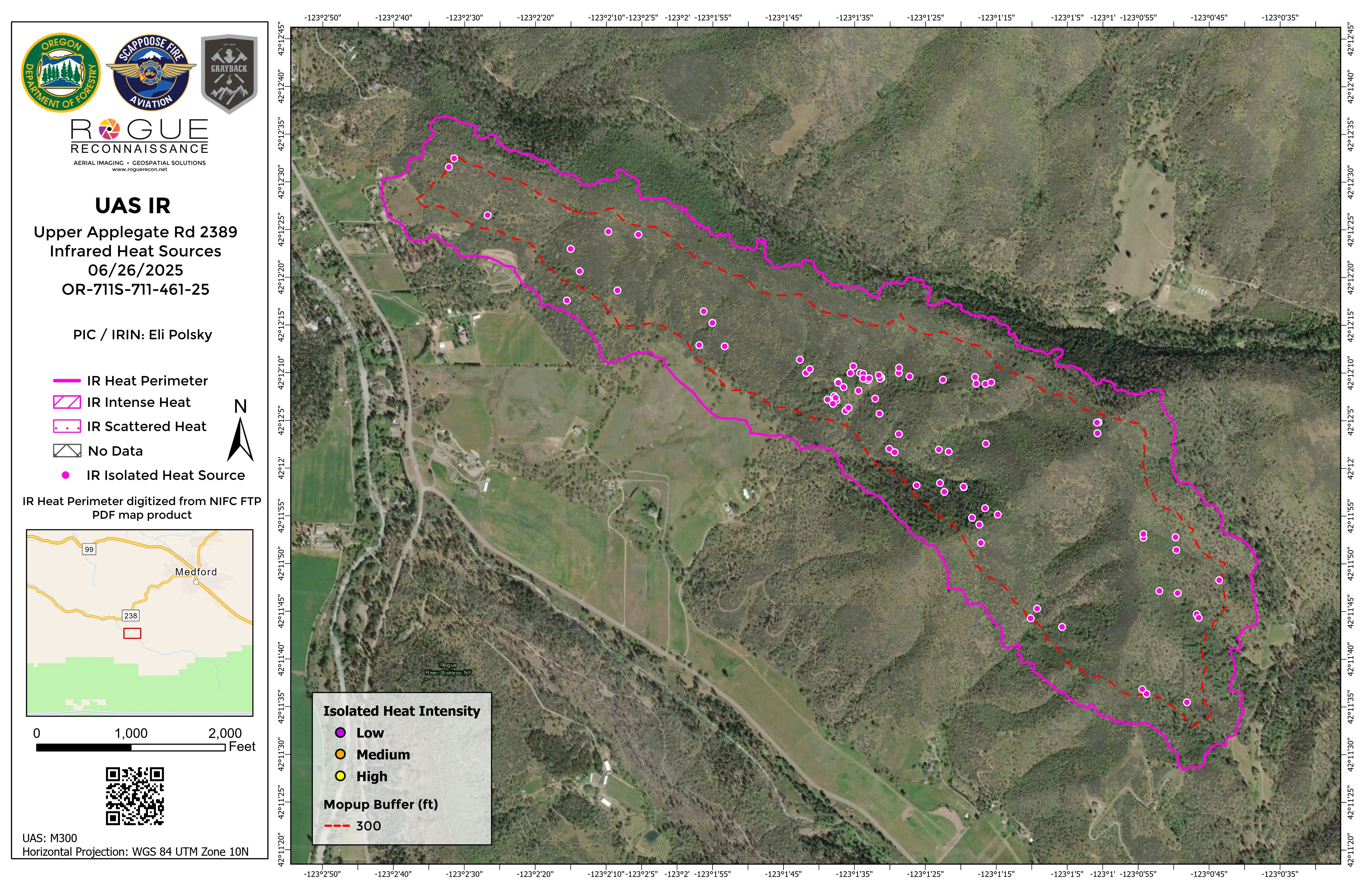
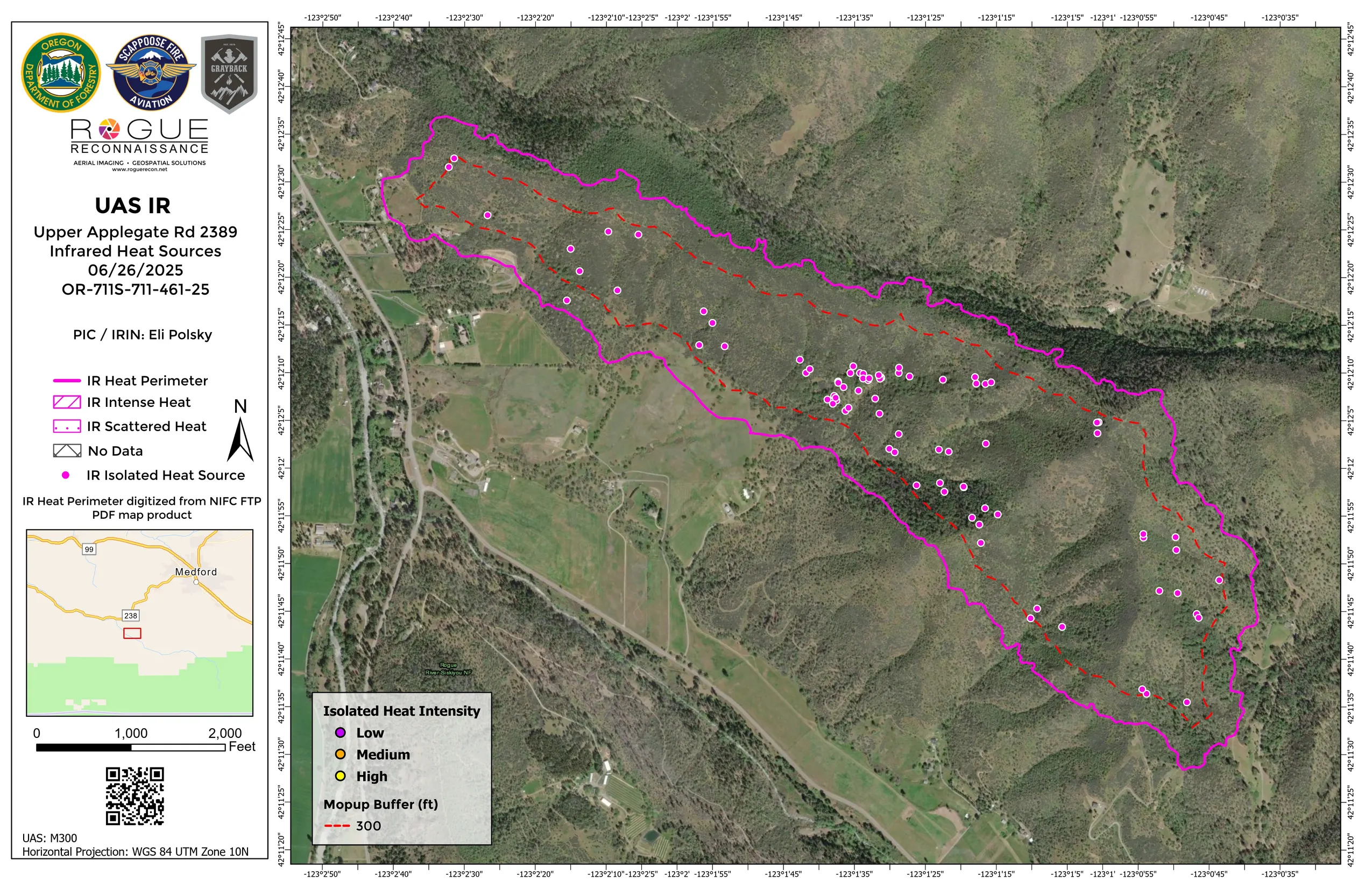
Upper Applegate Road
The perimeter on this sheet came from another product.
More about this sheet
- Incident
- OR-711S-711-461-25
- Aircraft
- DJI M300
As the sheet notes, it was digitized from the PDF map for the incident on NIFC's public share, and the drone's isolated heat sources were mapped against it, with a 300 foot mop up buffer inside.
Two sources on one page is now built into the pipeline. A pilot can attach the incident's current daily fire perimeter to a submission, and it is drawn beside the drone's own heat on every product.
- Upper Applegate Road, June 26, 2025. Open the full sheet ›
-
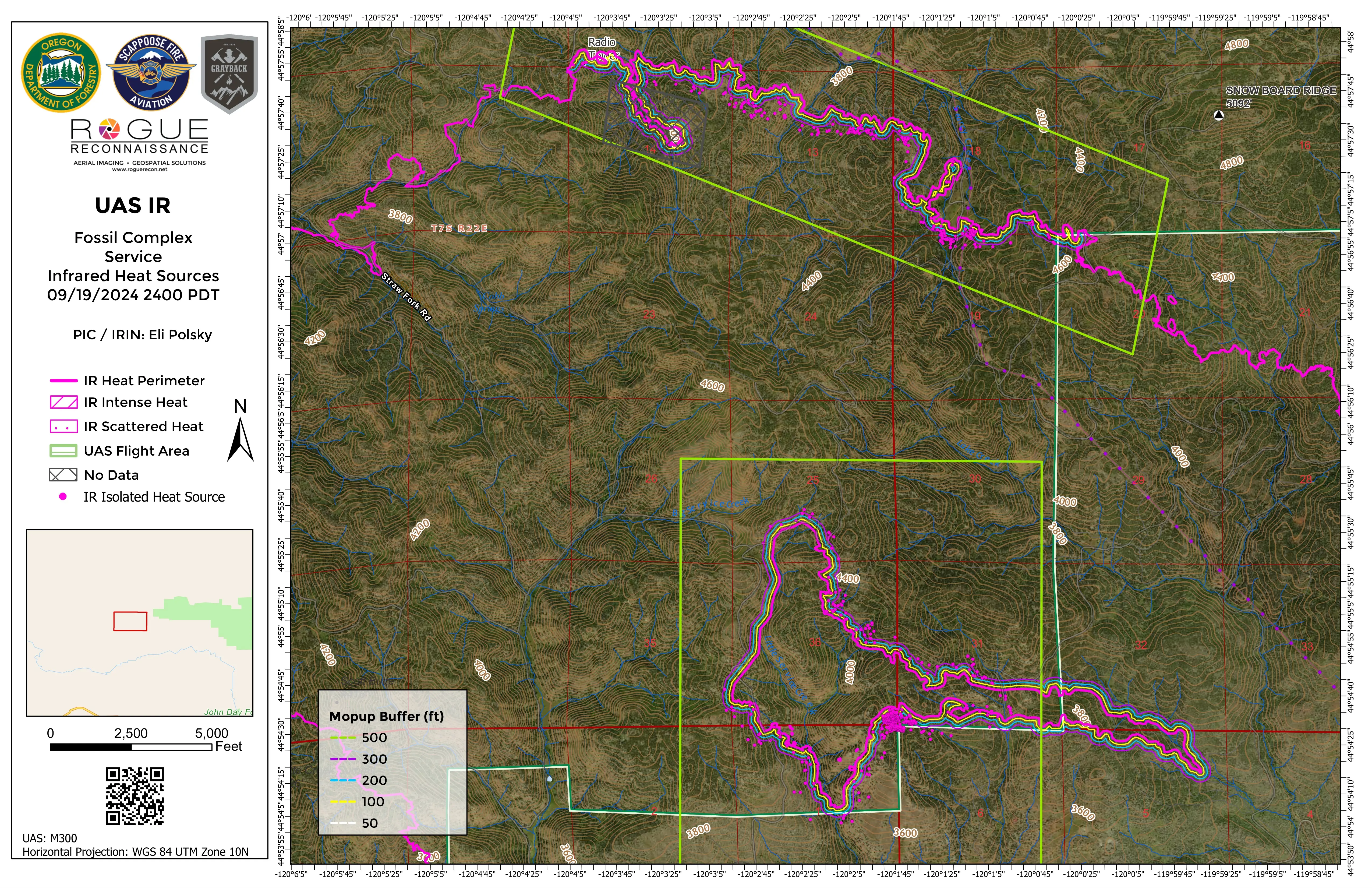
Service Fossil Complex
Two separate flight areas along the heat perimeter, flown at midnight.
More about this sheet
- Aircraft
- DJI M300
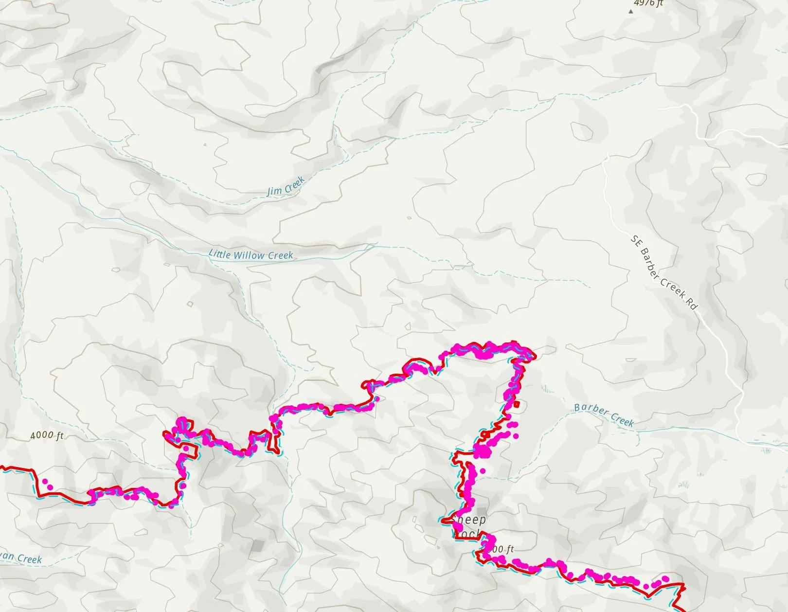
The remaining heat is isolated heat sources strung along the edge, with one dense cluster where the perimeter turns a corner.
This sheet carries the fullest set of mop up buffers on this page, at 50, 100, 200, 300 and 500 feet in from the heat perimeter, so a reader can judge at a glance how far from the edge any remaining heat sits.
- Service, Fossil Complex, September 19, 2024. Open the full sheet ›
-
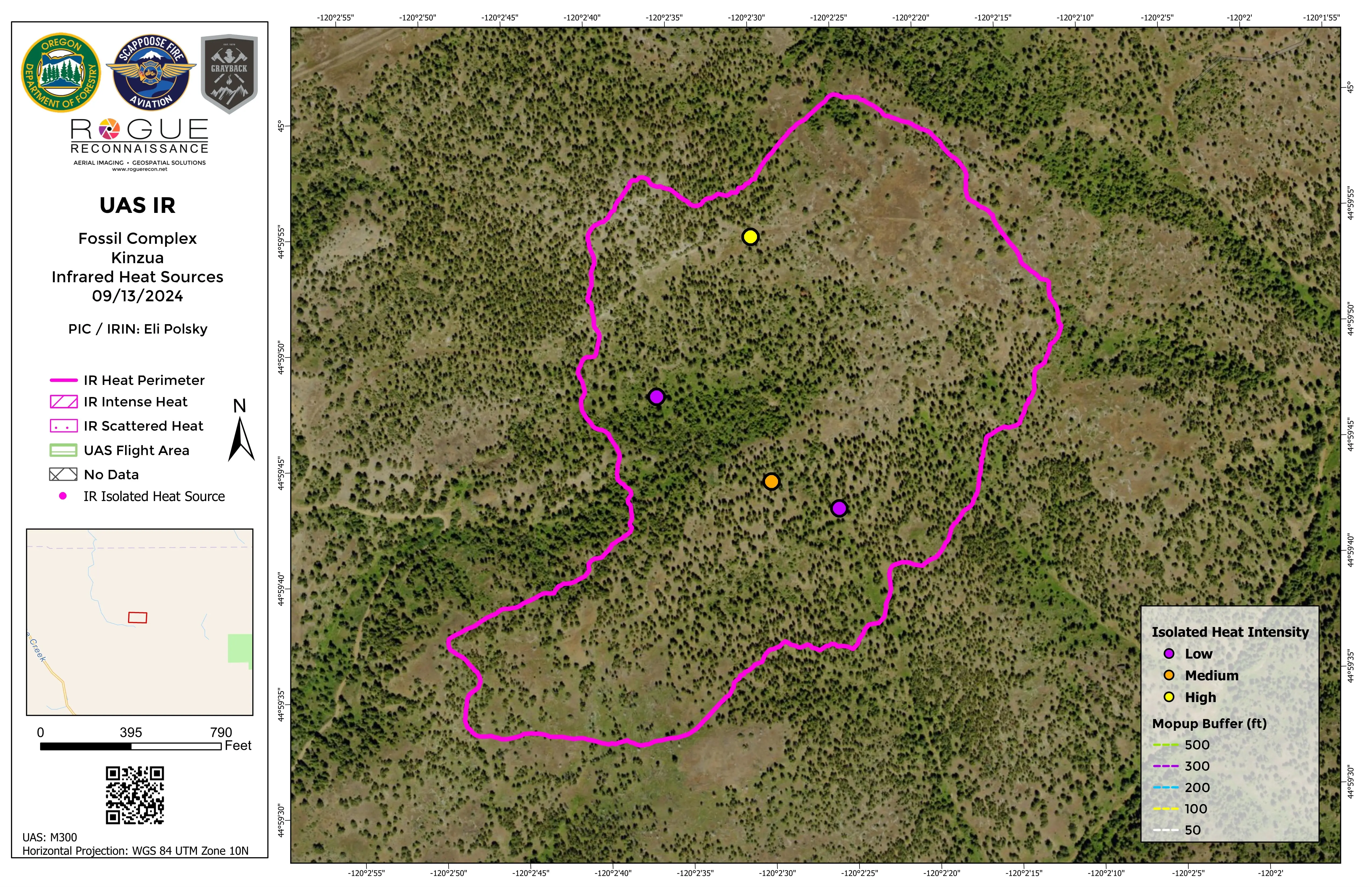
Kinzua Fossil Complex
A small perimeter with four isolated heat sources inside it: one high, one medium and two low.
More about this sheet
- Aircraft
- DJI M300
It is the plainest sheet on this page and one of the most useful kinds. It says clearly that very little heat is left, and exactly where that little is.
- Kinzua, Fossil Complex, September 13, 2024. Open the full sheet ›
-
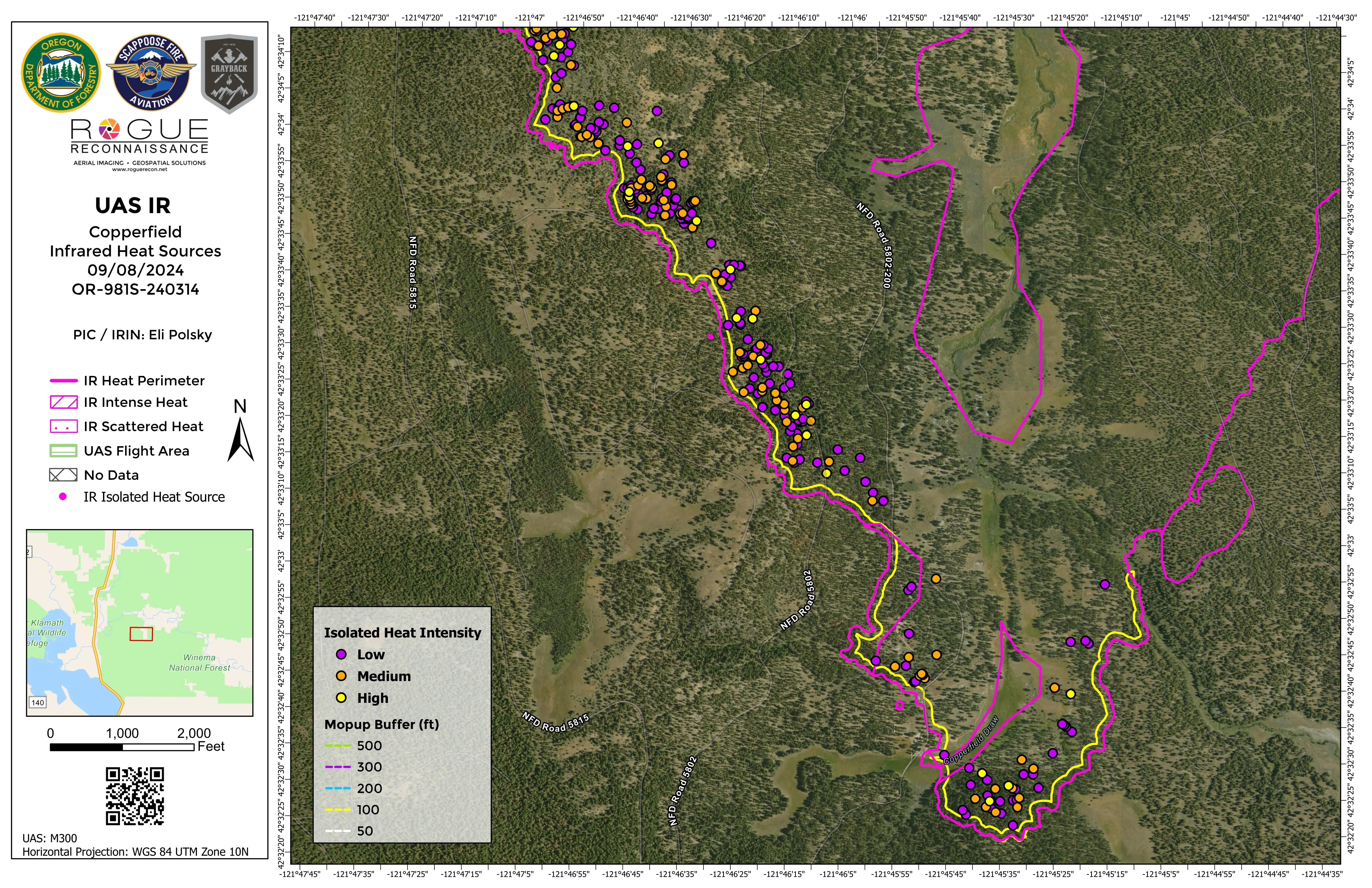
Copperfield
Heat along one long edge of the fire.
More about this sheet
- Incident
- OR-981S-240314
- Aircraft
- DJI M300
A dense band of isolated heat sources, each graded by intensity, runs just inside the heat perimeter, and a 100 foot mop up buffer traces the edge beside it. Most of the band sits beyond that buffer, deeper in than 100 feet.
For a crew assigned to that edge, the sheet shows where the work is, source by source.
- Copperfield, September 8, 2024. Open the full sheet ›
-
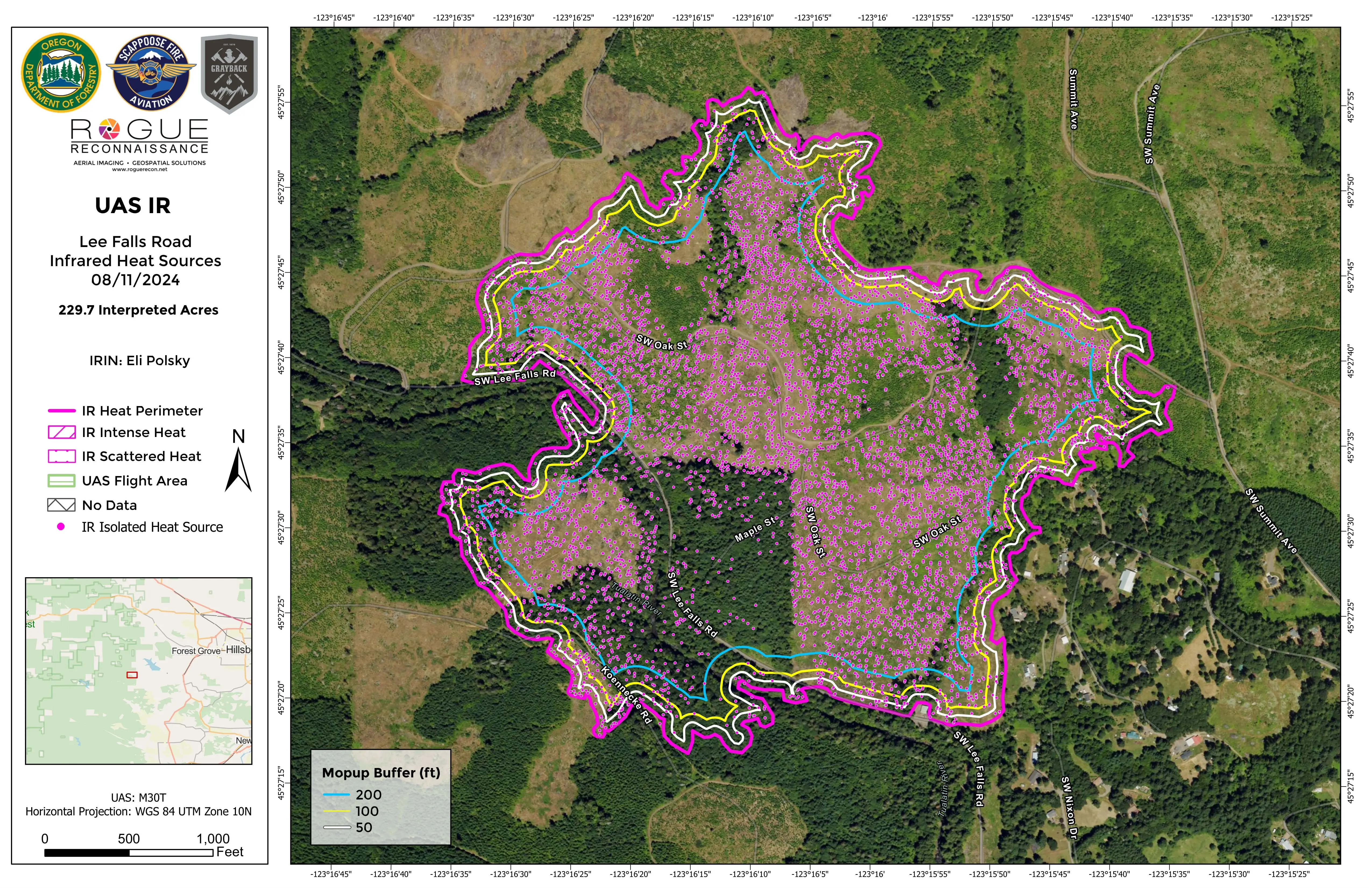
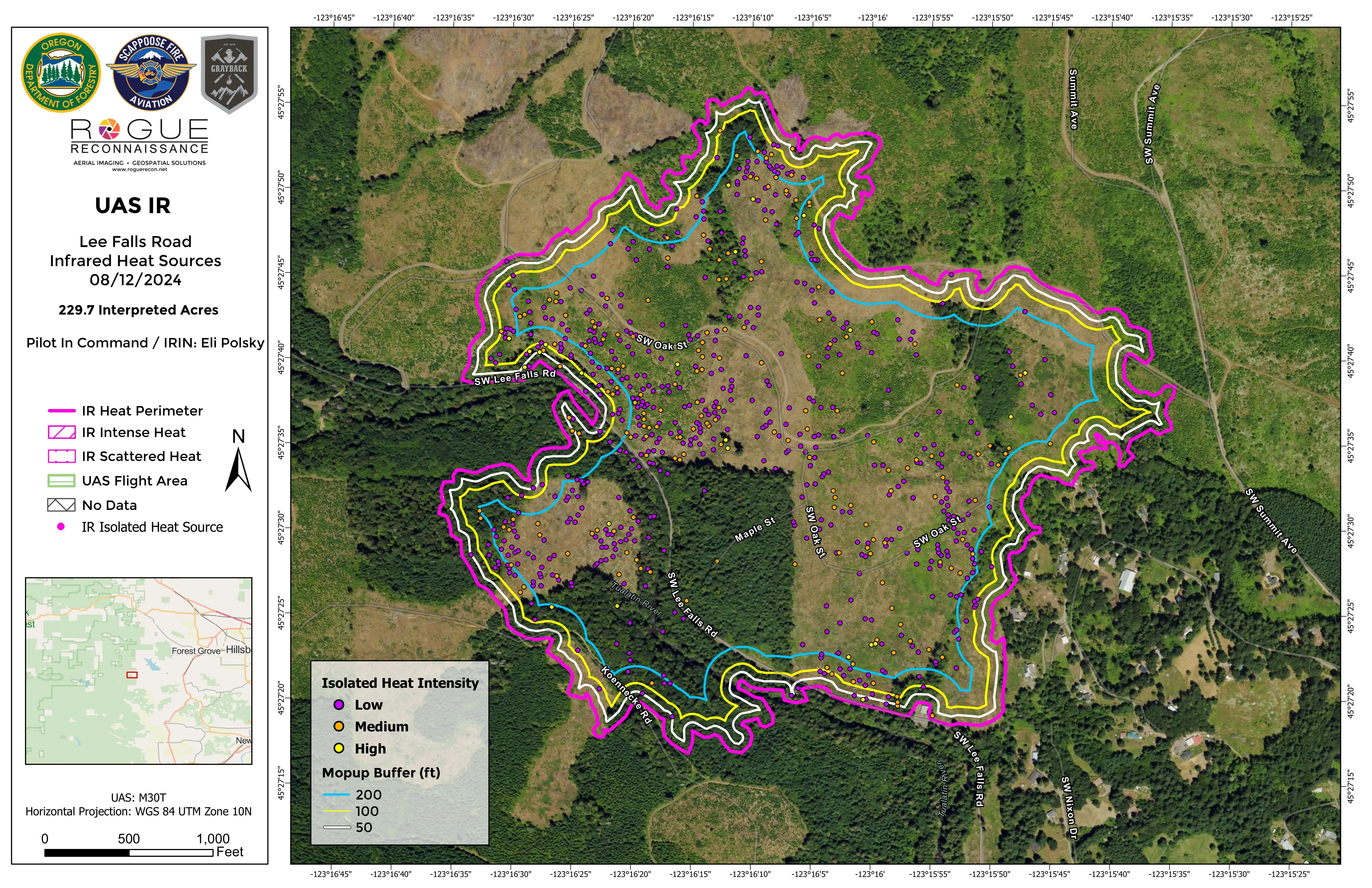
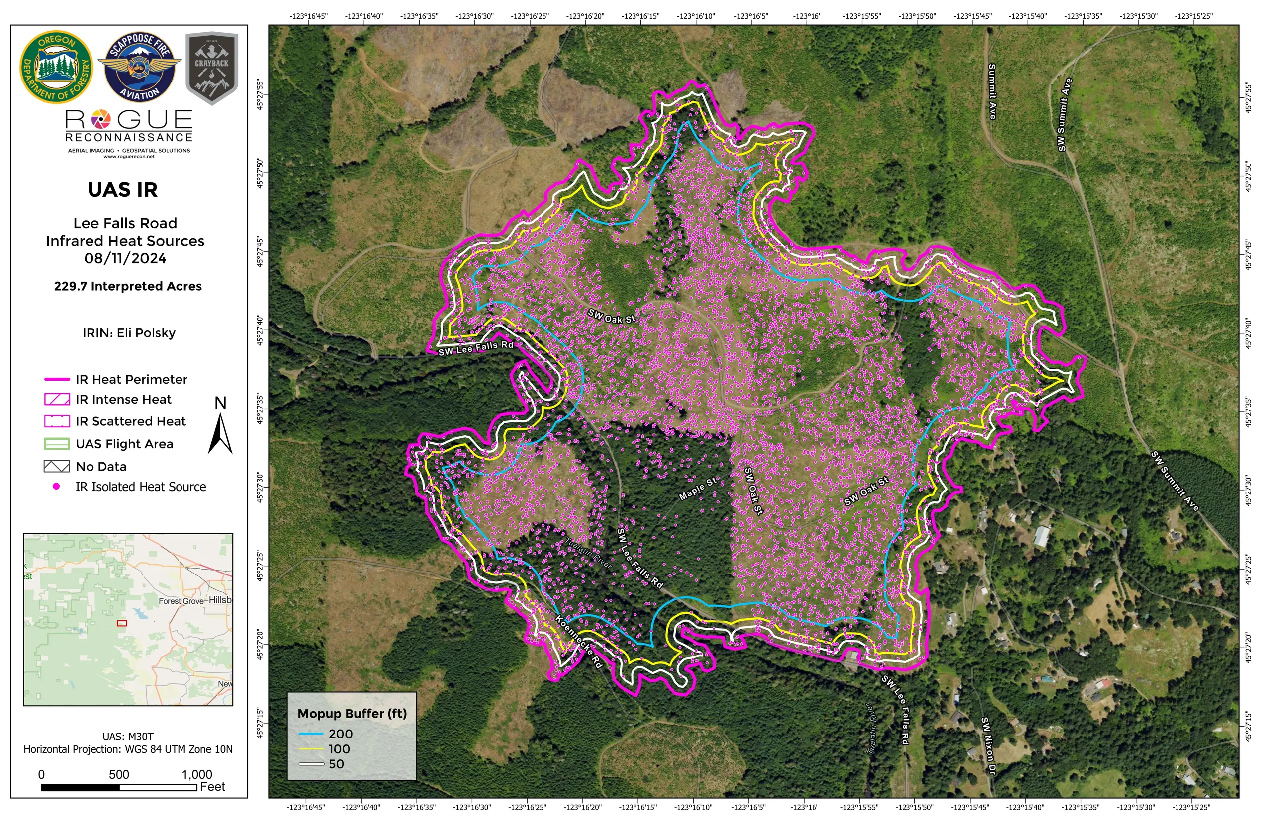
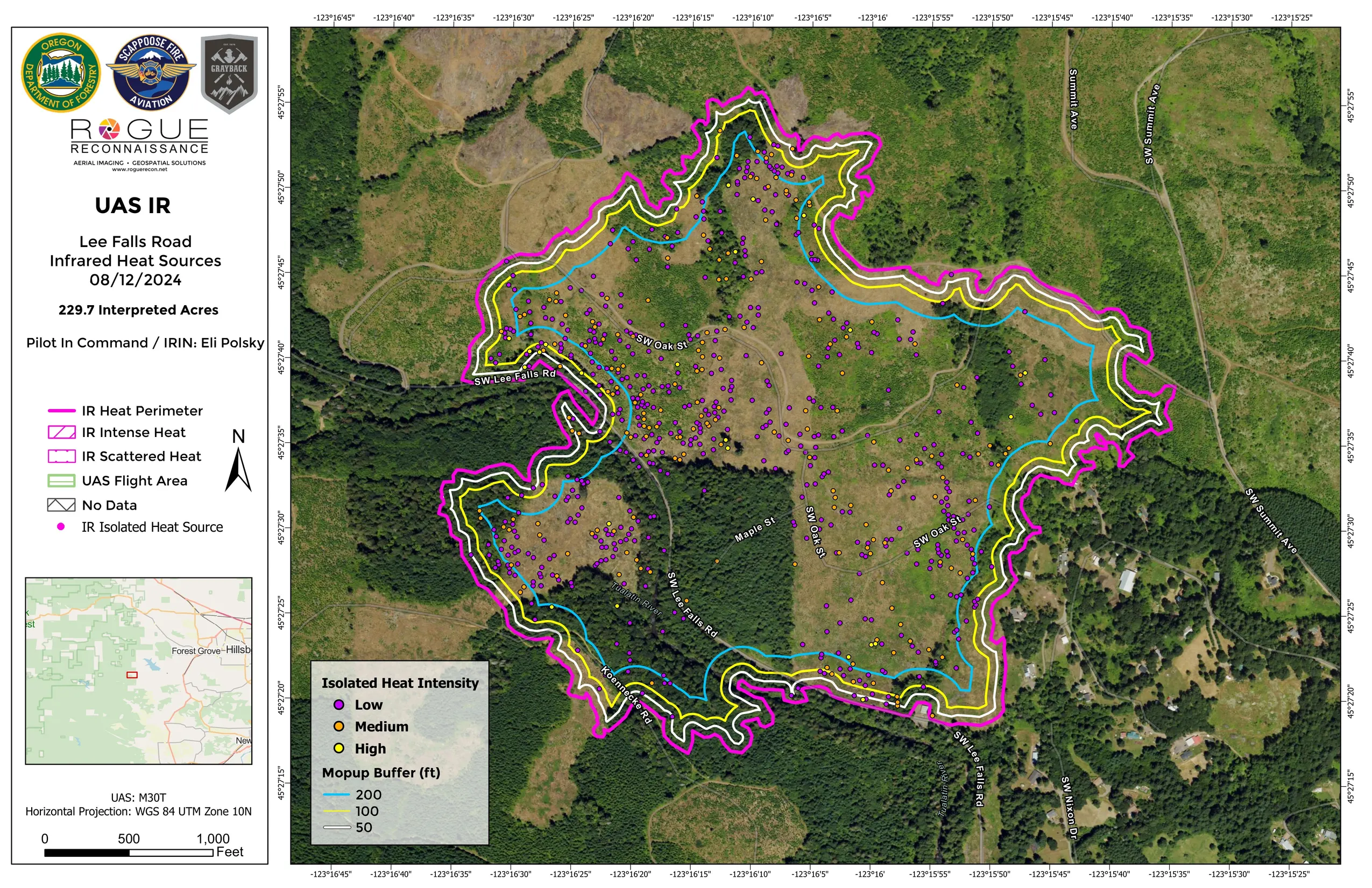
Lee Falls Road
Two consecutive nights over the same 229.7 interpreted acres.
More about this sheet
- Aircraft
- DJI M30T
On the first, the interior is dense with isolated heat sources. The second sheet grades each source low, medium or high, and there are visibly fewer of them. The two are different kinds of sheet, so compare them by eye rather than as a measure of how much the interior cooled.
Mop up buffers at 50, 100 and 200 feet run inside the heat perimeter on both. The August 12 sheet was finished at 3:56 in the morning, the delivery hour of an overnight flight.
- Night one, August 11, 2024. Open the full sheet ›
- Night two, August 12, 2024. Open the full sheet ›


Support the Collaborative
Keep the next map in a crew's hands.
Heat hides in stumps and roots after the flames pass. The system that maps it for crews is running on live incidents, and a gift keeps it ready for the next fire season.