2026 wildfire Jackson County, Oregon
Fielder Mountain
Night after night over the same steep ground, and what happened to the heat inside a perimeter that never moved.
- Nights of maps
- 11
- August 15 to August 26
- Map sets delivered
- 13
- Flown by Rogue Reconnaissance, the founder's company
- Heat sources on the busiest map
- 2,852
- Perimeter scan, night of August 15
- Acres on the incident record
- 573
- Read September 13, 2026
The same ground, every night but one
Fielder Mountain was reported on August 13 on steep ground in Jackson County. Rogue Reconnaissance, the founder’s company, flew it every night but one from August 15 to August 26, and the heat perimeter on the maps stayed at about 575 acres the whole time. The fire was not getting bigger.
What changed was the heat inside it. The first map carried 2,852 heat sources. The last carried 58. Every one of those sheets is further down this page, night by night.
Crews said they were finding more
On the night of August 19, the team and a division reported that crews on the ground were finding more hot spots than the maps showed. That night the pilot lowered the detection threshold, raised the sensitivity, and marked the lower confidence signatures as possible heat. Possible heat on the maps went from none on the first night to more than a hundred on the nights of August 19 and 21.
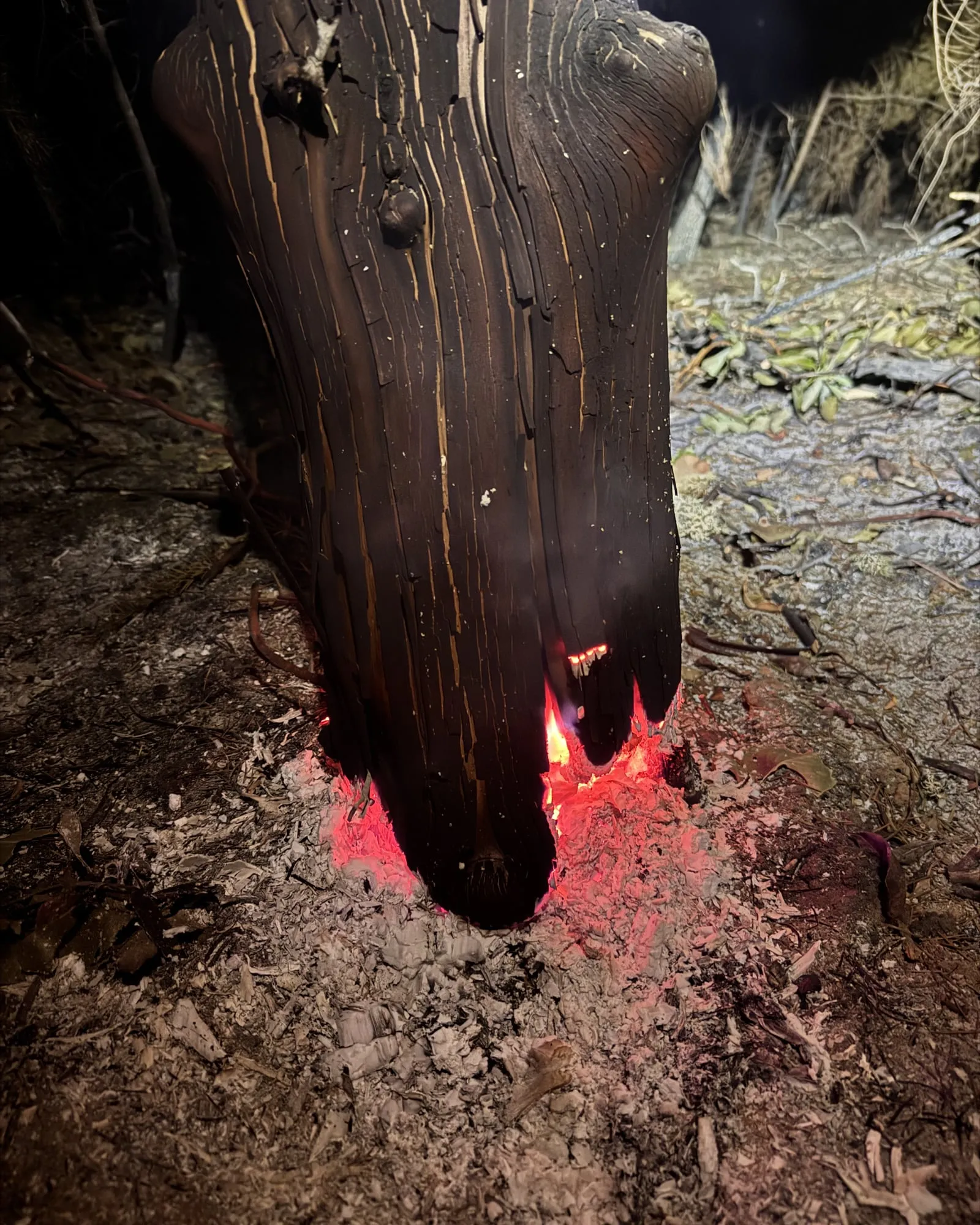
While the thermal mosaic stitched, the pilot walked out to check. Two of the signatures that night were a parked excavator’s engine and a pile of rocks still holding the day’s warmth. Neither was fire. The night before, the map’s high heat had led to a madrone still burning at its base. That is the whole case for possible heat: it tells a crew where to look, not what it will find.
On the night of August 21 the map showed a few suspicious signatures inside the mop up buffer near a home and close to the line, and the pilot reported them to the incident commander that night.
Sharing the sky
On the night of August 18, an Oregon Department of Forestry helicopter was training on night vision over the fire. The drone stood down while the helicopter was inside the temporary flight restriction and went back to work once it left, and the three map sets that night were flown around it.
Later in the assignment the flights started from the bottom of the fire and followed the terrain, for more detailed mosaics on the steep ground, and waited until later in the night, when cooler ground lets faint heat stand out.
On the ground
The fire, up close
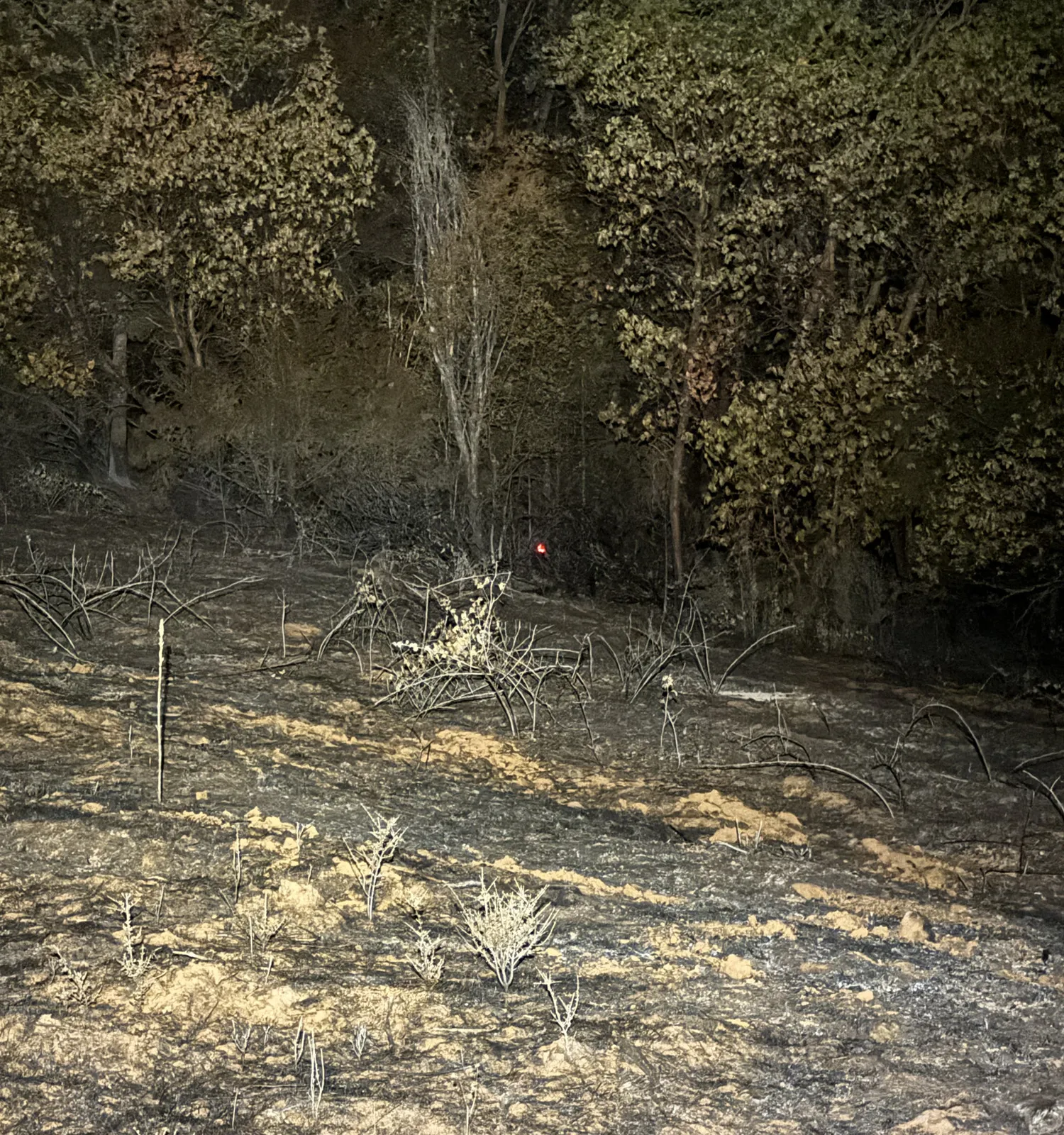
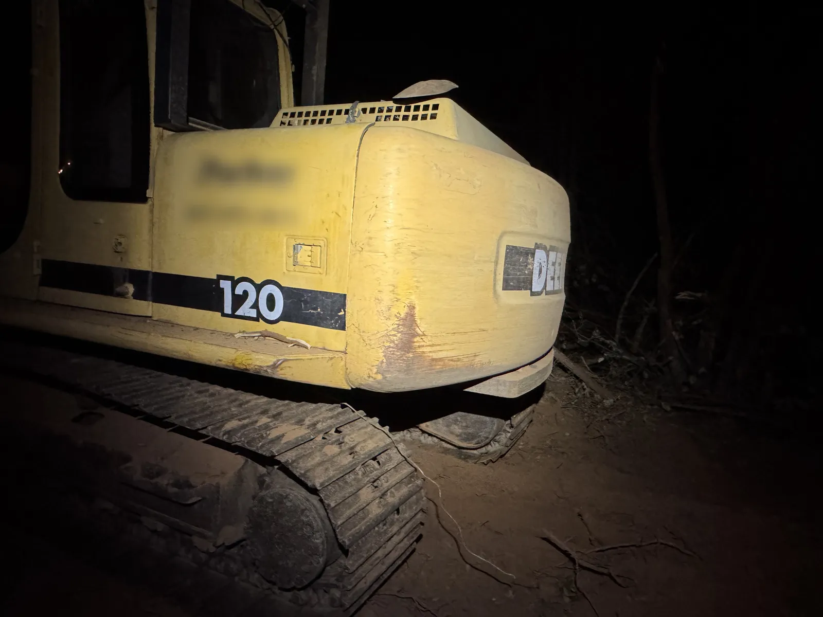
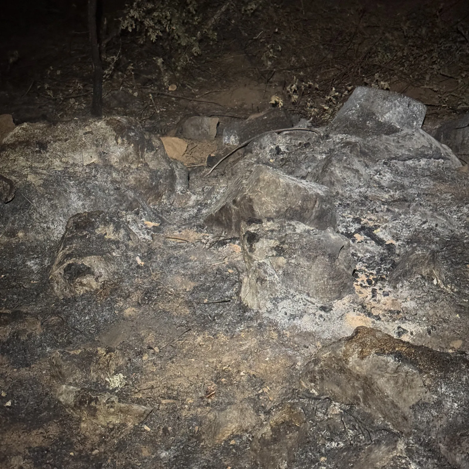
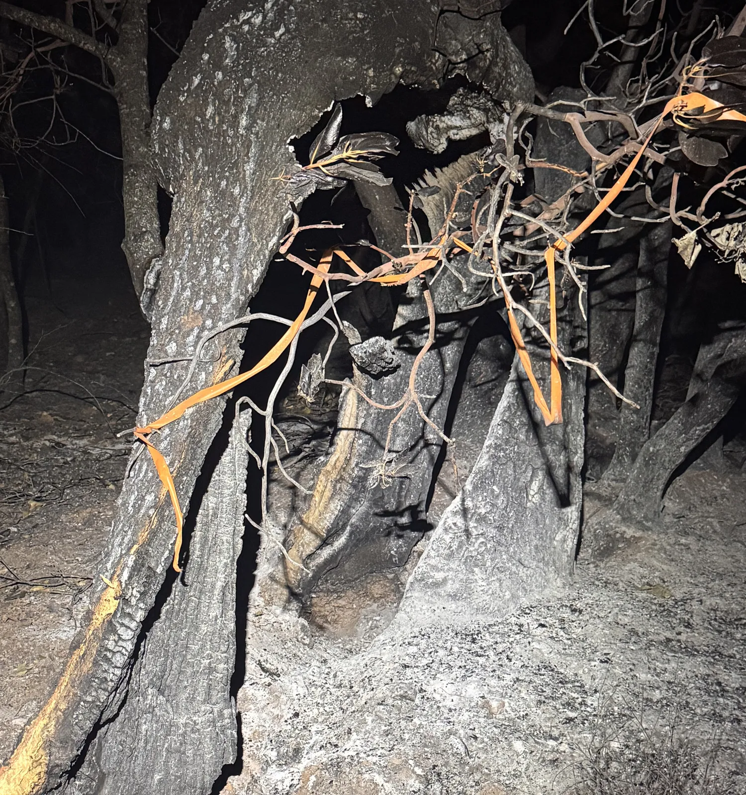
What the Collaborative did
One flying team. The system did the rest.
Every map set on this fire came back as two thermal map sheets, one on aerial imagery and one on a topographic base, with a daily log, a Google Earth file and the GIS layers, on the flying organization’s own template.
- 78 files in the public archive Filed by night under the folder and file names the interagency share uses, free for anyone to open.
- 9 map sets carry the daily fire perimeter The incident’s own interagency perimeter, pulled onto the map in red beside the drone’s pink heat.
- 45 min median, upload to approved maps Across 13 map sets with both times on the record, including the pilot’s own review before approving.
- 50 to 400 ft mop up buffers drawn Dashed lines a set distance in from the perimeter, measured along the ground, so a crew can see which heat sits close to the edge.
How a map is made
The first night on Fielder Mountain, layer by layer
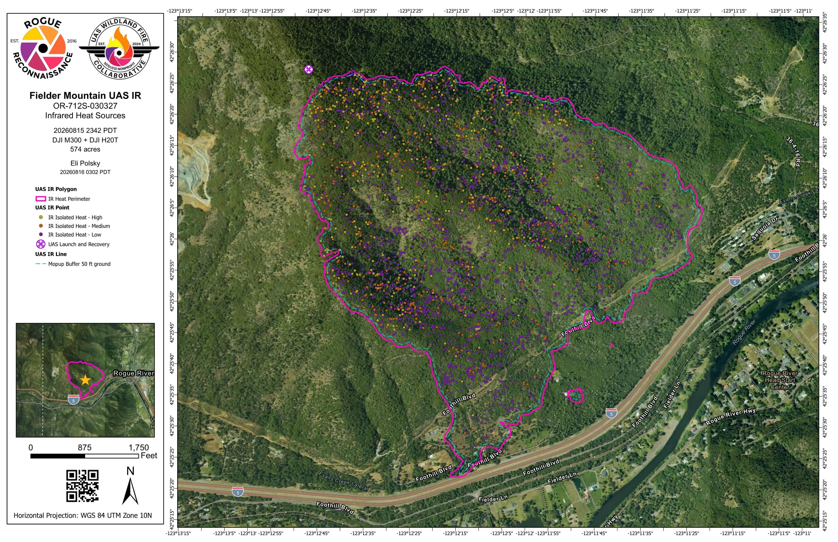
The whole fire at 11:42 pm on August 15. First the stitched thermal mosaic from that flight, then each layer the delivered map set draws on top of it.
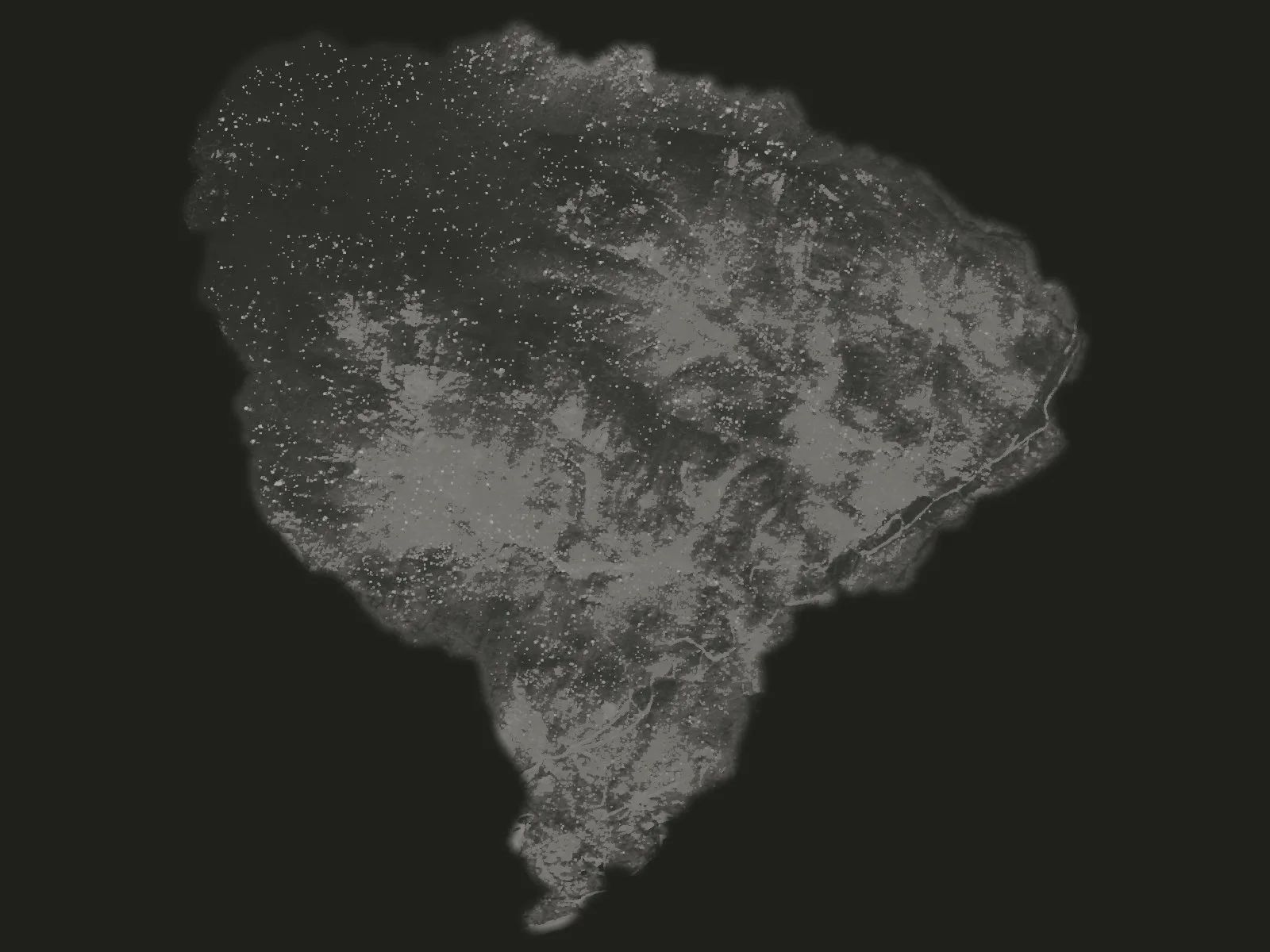
- The thermal mosaic Hundreds of thermal frames from one night's flight, stitched into one thermal image of the ground. The whiter the ground, the warmer it reads.
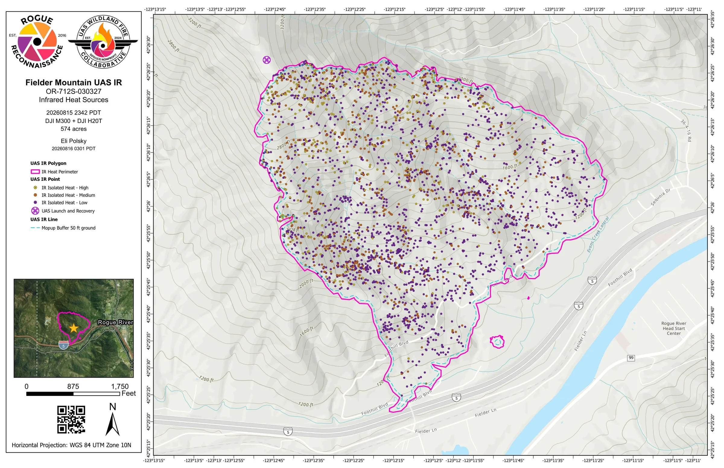
- IR heat perimeter The outer edge of the heat, as the pilot mapped it, drawn in pink because a drone flew it.
- 2,852 isolated heat sources Each single heat source, graded high, medium or low against the rest of the flight, in yellow, orange and purple. Each is a place a crew can walk to.
- Mop up buffer A dashed line a set distance in from the heat perimeter, so a crew can see which heat sits close to the edge.
- Launch and recovery Where the crew launched and landed the aircraft.
-
Pink is a drone. Red came from elsewhere: a crewed aircraft's map or the incident's daily fire perimeter. Every map the Collaborative makes follows that rule, so anyone on the fire can see at a glance what the drone found.
How to read the map
Delivered to the incident
More thermal map sheets from Fielder Mountain
Pink is a drone Red came from elsewhere How to read the map
Night by night
One sheet a night
The map from every aerial sheet delivered on Fielder Mountain, one per night, with the number of heat sources it carried. On August 18 it is the whole fire sheet of the three delivered that night. Each opens as the PDF the incident received.
-
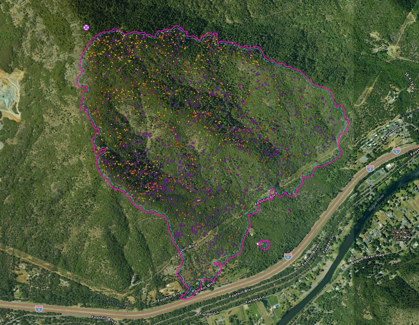 August 152,852 heat sources
-
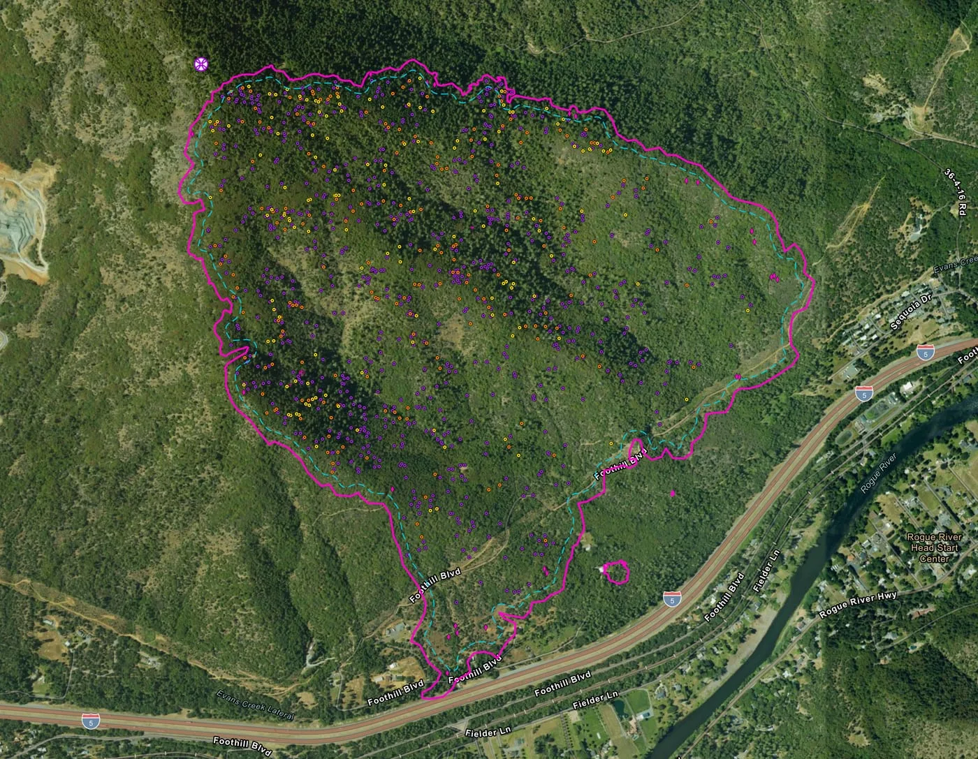 August 161,054 heat sources
-
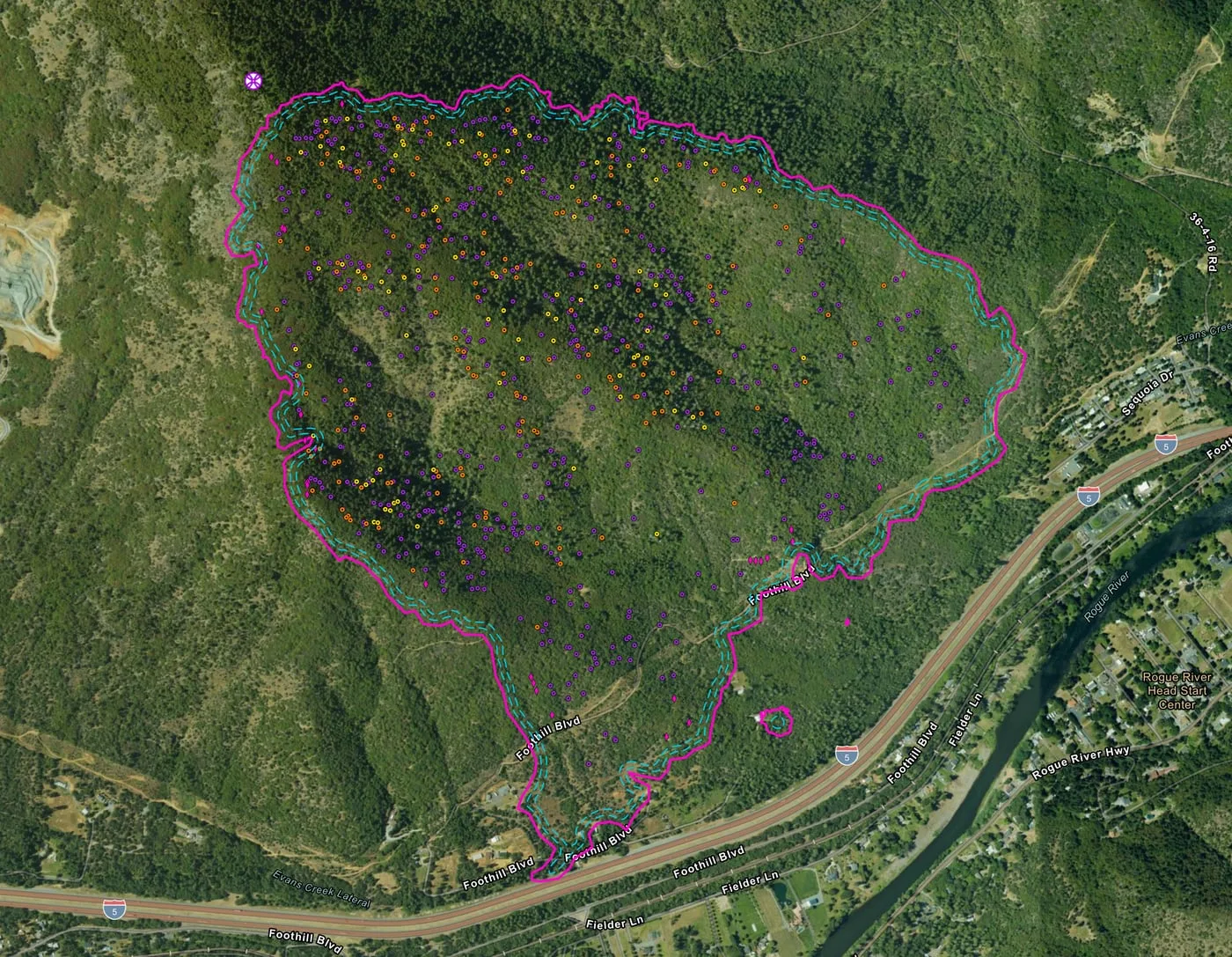 August 17783 heat sources
-
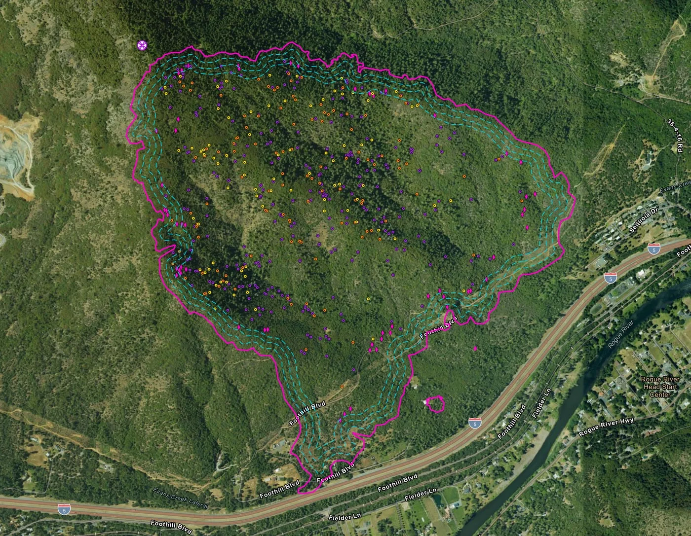 August 18465 heat sources
-
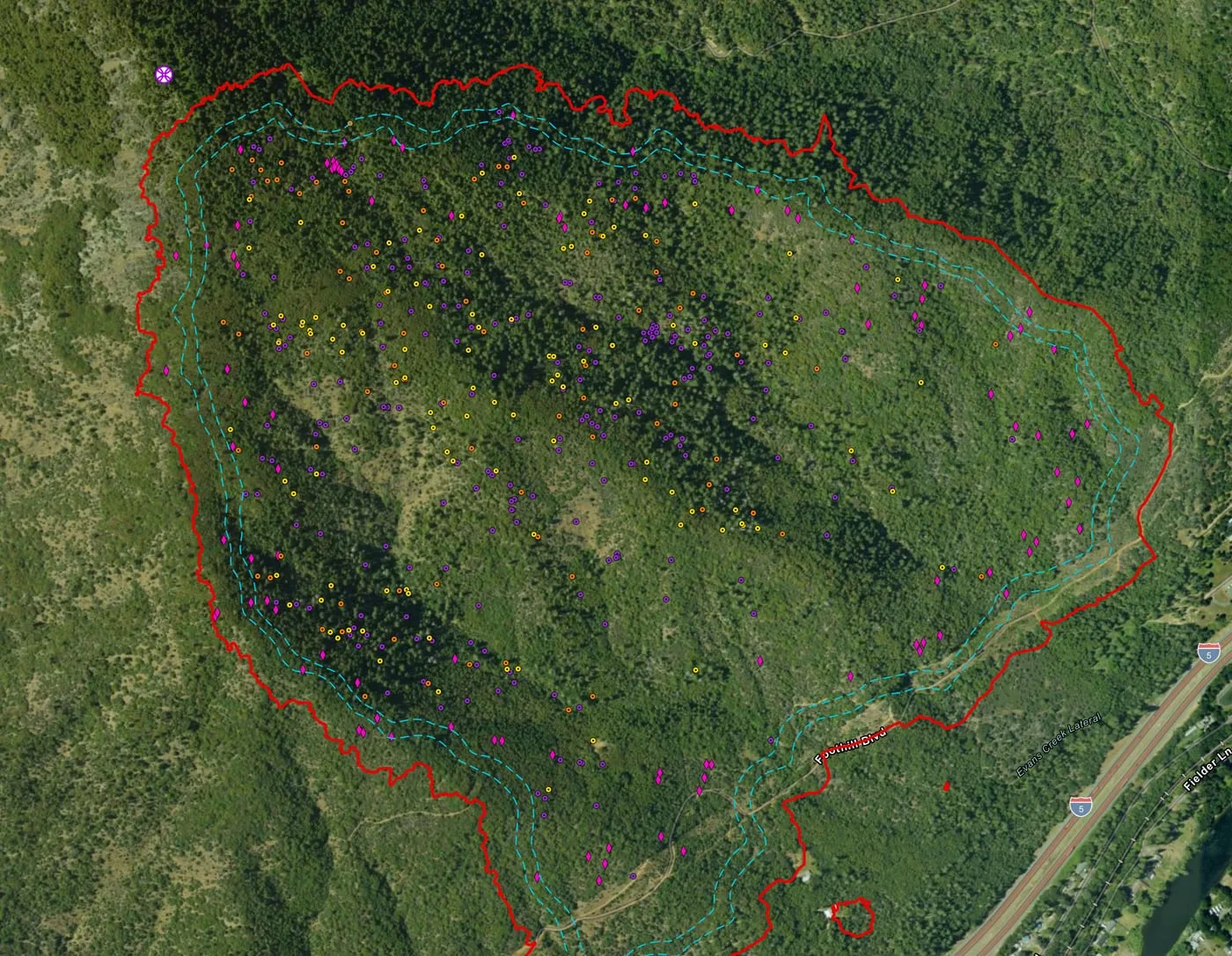 August 19436 heat sources
-
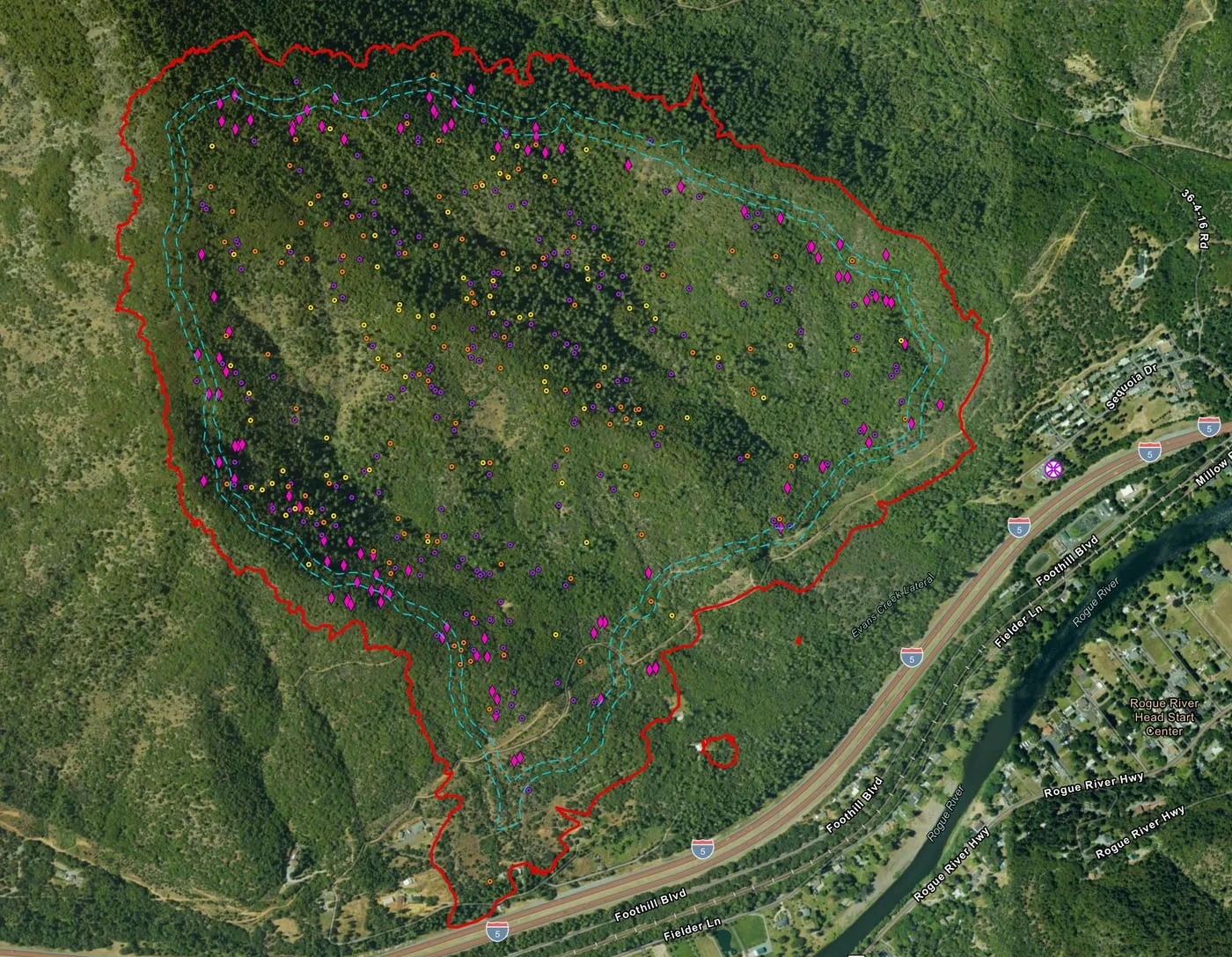 August 21400 heat sources
-
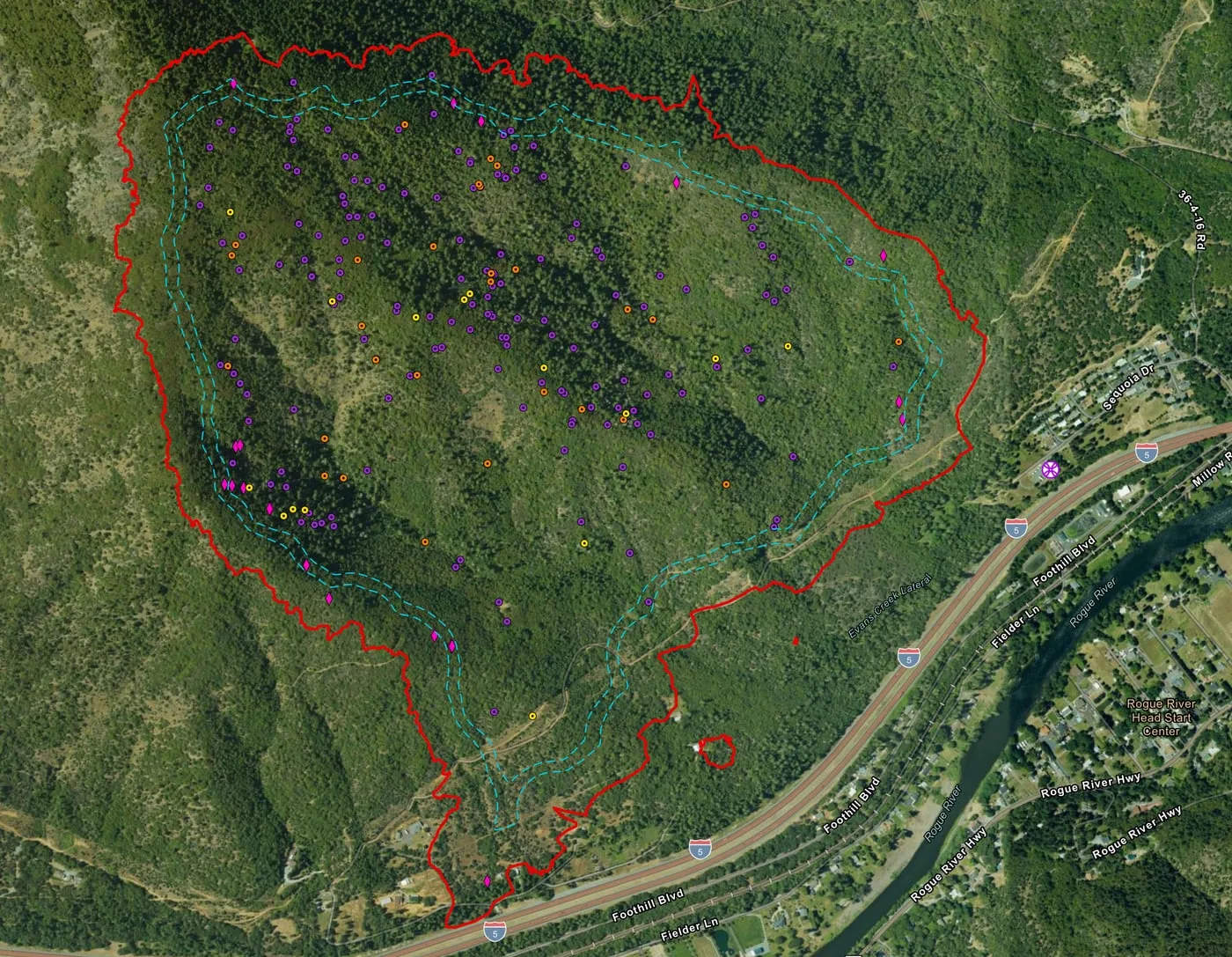 August 22216 heat sources
-
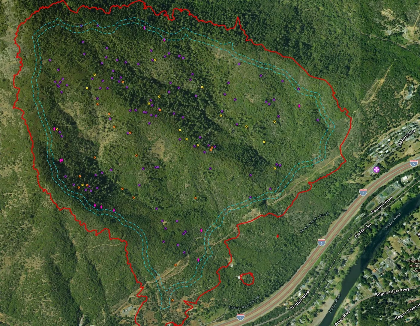 August 23150 heat sources
-
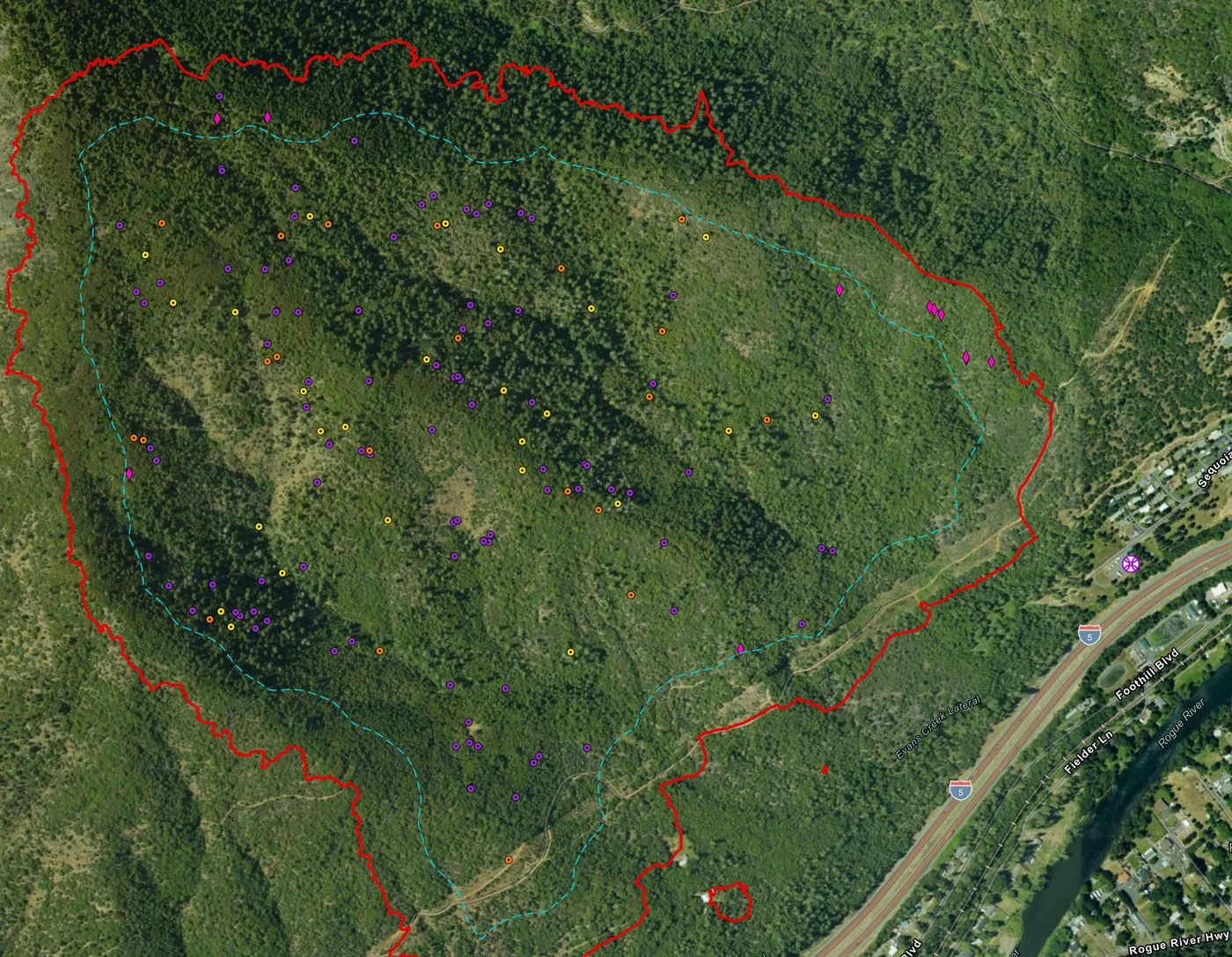 August 24155 heat sources
-
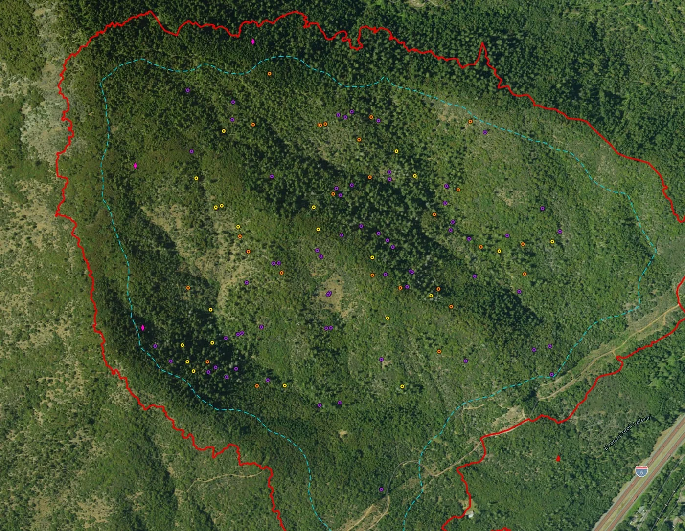 August 25119 heat sources
-
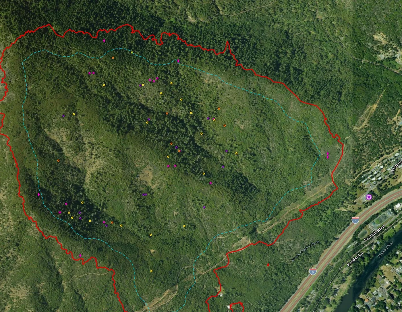 August 2658 heat sources
August 15 2,852 heat sources
Drag the slider or use the arrow keys. The map opens as the PDF the incident received.
The archive, night by night
Every map set
13 map sets over 11 nights
One row per map set, grouped by night. A flight after midnight counts with the night before it, and the archive files each night under the next day's date, the operational period its maps served. Where two flights covered the same ground in one night, a heat source can appear on both maps, so the nightly numbers are not added into a trend.
| Night | Flown | Area | Heat sources | Possible heat | Mop up buffer | Archive |
|---|---|---|---|---|---|---|
| August 15 | 11:42 pm | Perimeter scan | 2,852 | 0 | 50 ft | Open the night |
| August 16 | 2:22 am | Perimeter scan | 1,054 | 24 | 100 ft | Open the night |
| August 17 | 12:03 am | Perimeter scan | 783 | 39 | 50, 100 ft | Open the night |
| August 18 | 12:38 am | Whole fire | 465 | 57 | 100, 200, 300 ft | Open the night |
| 12:56 am | Division G and L | 253 | 23 | 100, 200, 300 ft | ||
| 1:04 am | Division C and W | 238 | 34 | 100, 200, 300 ft | ||
| August 19 | 3:18 am | Perimeter scan | 436 | 101 | 200, 300 ft | Open the night |
| August 21 | 2:31 am | Perimeter scan | 400 | 106 | 300, 400 ft | Open the night |
| August 22 | 1:38 am | Perimeter scan | 216 | 20 | 300, 400 ft | Open the night |
| August 23 | 3:35 am | Perimeter scan | 150 | 11 | 300, 400 ft | Open the night |
| August 24 | 1:35 am | Perimeter scan | 155 | 11 | 400 ft | Open the night |
| August 25 | 4:31 am | Perimeter scan | 119 | 3 | 400 ft | Open the night |
| August 26 | 1:38 am | Perimeter scan | 58 | 6 | 400 ft | Open the night |
Counted September 13, 2026 from the submission records and the public archive.
Where the images came from
- Every sheet on this page is the PDF delivered to the incident and published in the public archive, rendered as an image without changes. Each links to its PDF.
- Photographs by Rogue Reconnaissance, the founder's company, dated from each photo's own record. The contractor's name on the excavator is blurred.
More from the 2026 season
Other case studies
-
Bologna
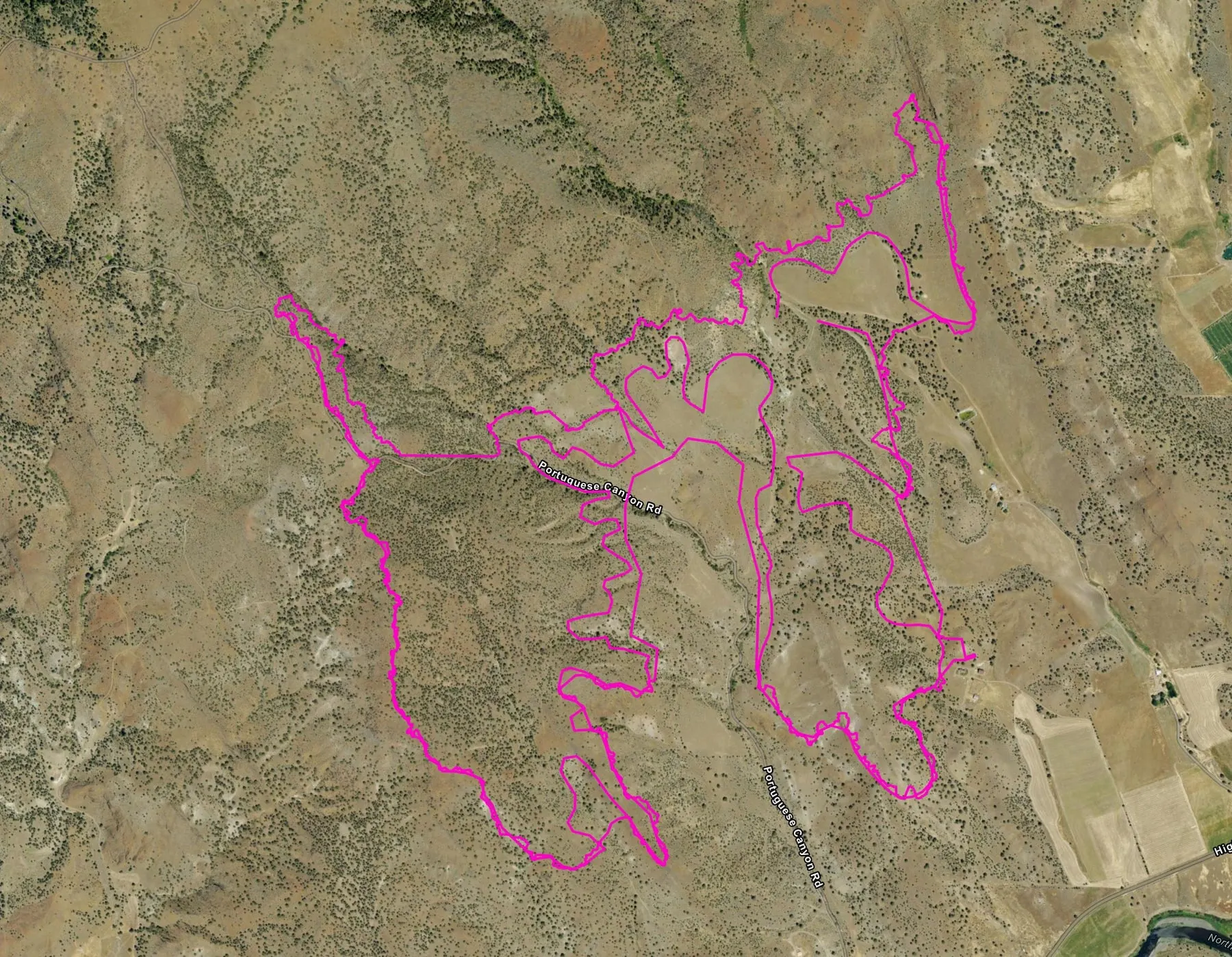
A pink heat perimeter from a state drone, then a week of flights along the line as the heat near it faded.
-
East Evans Creek
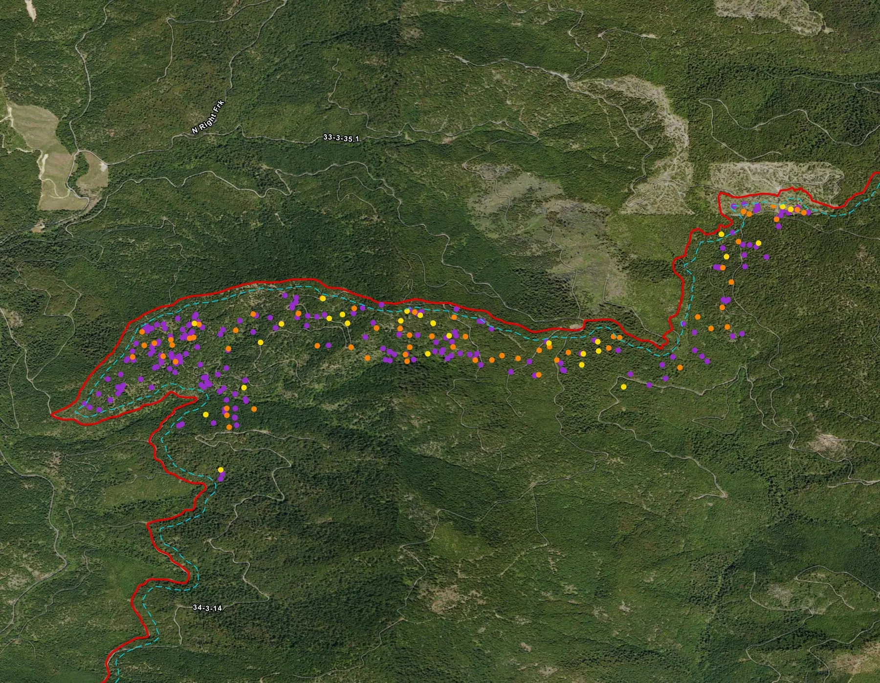
The fire where the 2026 season's first automated map sets were made, mapped division by division for three weeks by two organizations.
-
Brewer
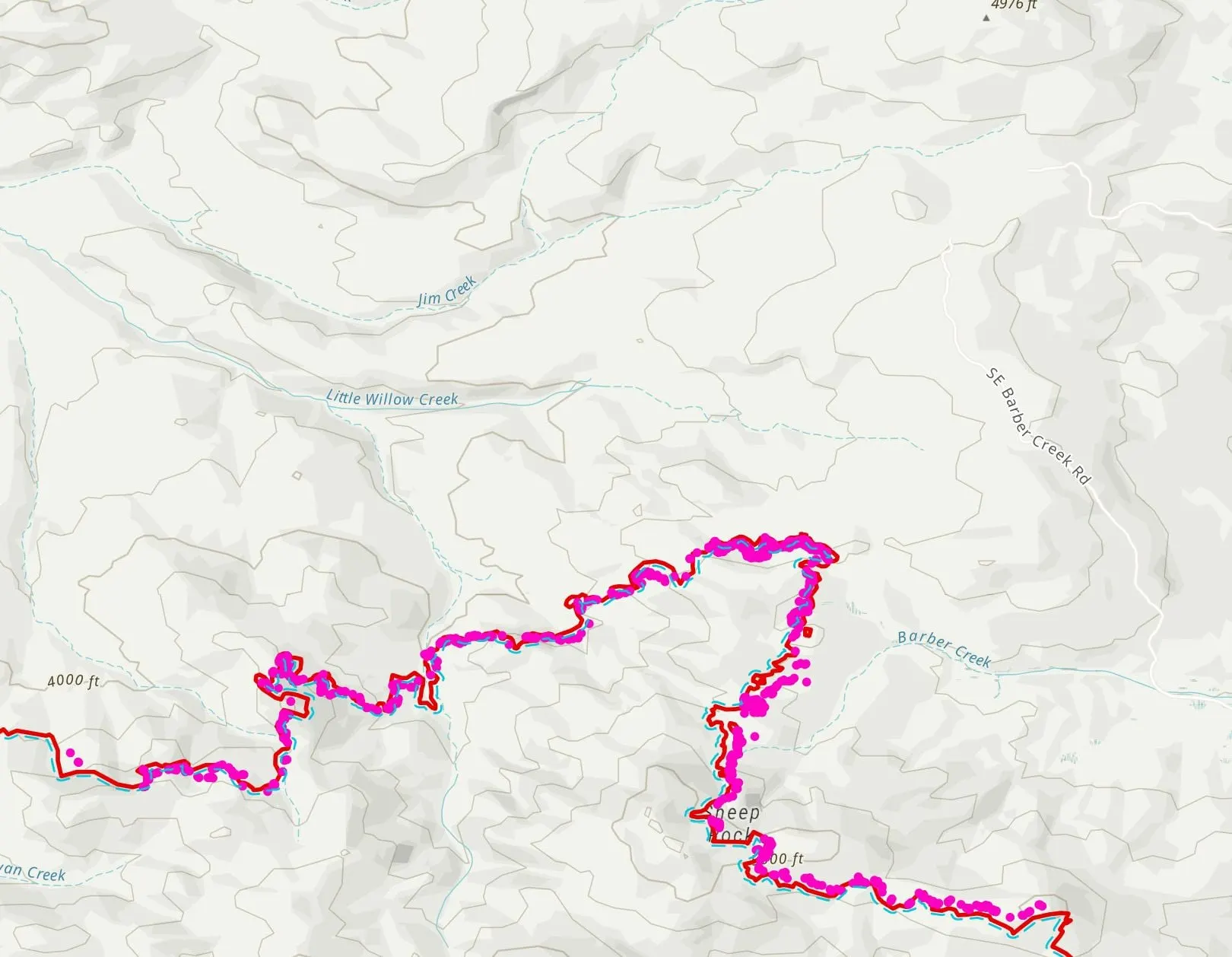
Drone heat along the daily fire perimeter, heat mapped outside it for spot fires, and a crewed aircraft's own flights turned into the same map set.
Support the Collaborative
Every sheet on this page went to the incident.
A gift keeps the system running for the next fire, so the heat still in the ground reaches the incident on a sheet like these.