UAS Wildland Fire Collaborative
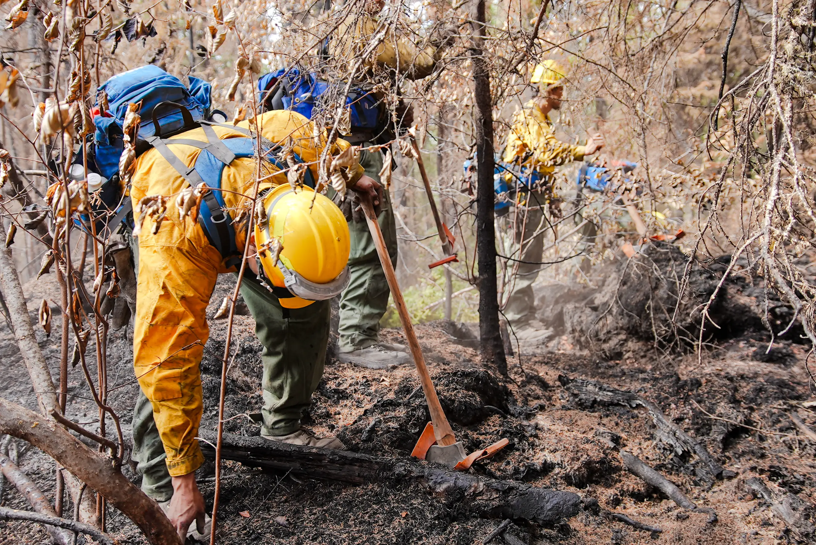
Less heat between firefighters and the line.
A standardized pipeline for all UAS wildland fire data. IR mapping, ignitions, recon, video, panoramas, processed and delivered the same hour.
One system for every wildland fire drone pilot, state, private contractor, or federal, on any incident, in any state.
What the Collaborative does
-
For pilots
A standardized pipeline behind your aircraft. You fly. Raw thermal data goes in. Calibrated, standardized geospatial deliverables come out, ready for GIS teams, NIFC FTP, Intterra, IMTs, and ground resources. A templated map carries your name and your logo on the product.
Want to be part of the Collaborative? Reach out -
For decision makers
Operational intelligence in the formats incident teams already trust. Live feature services, NIFS schema deliverables, and IR logs delivered the moment a pilot approves the package.
Bring it to your incident -
For crews
Less time walking into heat that better intelligence would have flagged. Fewer surprises on the line. Reduced exposure is the reason every other piece of this exists.
Learn more
What it looks like
From the air to the line.
Thermal data from a pilot's drone, processed into standardized geospatial deliverables (perimeter and heat polygons), delivered as a live feature service the same hour. The output is a templated map carrying the pilot's logo, ready for the incident team to use.
Why it matters
Crews are walking into heat that pilots in the air could already see.
Thermal cameras are mounted to UAS over fires every day. The data exists. The bottleneck is getting it processed, standardized, and into the right hands before crews are committed.
When a pilot's data sits in proprietary formats, gets stuck in email, or arrives in shapes the IMT cannot read, ground resources keep working off yesterday's picture. Hot pockets get missed. Lines get pushed into heat. Exposure is the cost.
We are pilots ourselves. We built the Collaborative so the data we already collect reaches crews in time to matter.
How it works
One simple form to a templated, branded deliverable in minutes.
The pilot does what they already do. The pipeline takes it from there. The map that lands on the receiving team's desk carries the pilot's logo.
-
Submit
Pilot uploads thermal imagery and fills out one simple form. No Survey123 install, no shared drives, no email chains.
-
Process
Pipeline orthorectifies, classifies heat, and builds standardized geospatial deliverables within minutes.
-
Approve
Pilot reviews the draft package by email and confirms accuracy in two clicks.
-
Deliver
Five products land on the NIFC FTP. Live feature service goes online for the IMT. A templated map carrying the pilot's logo lands in the hands of the receiving team, with streaming to Intterra for partners on that platform.
What we've mapped
Real maps from real fires.
from 6 incidents
-
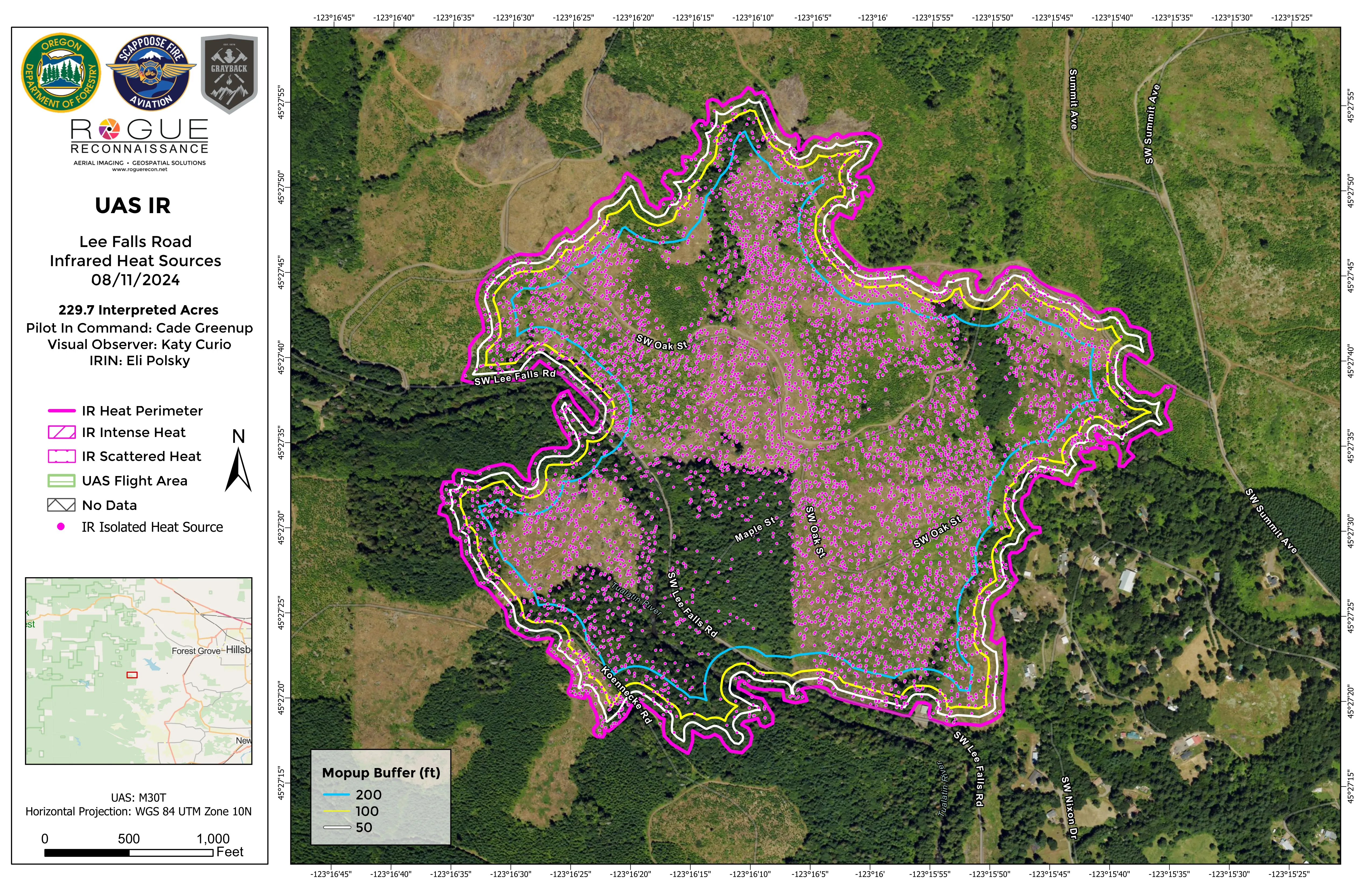
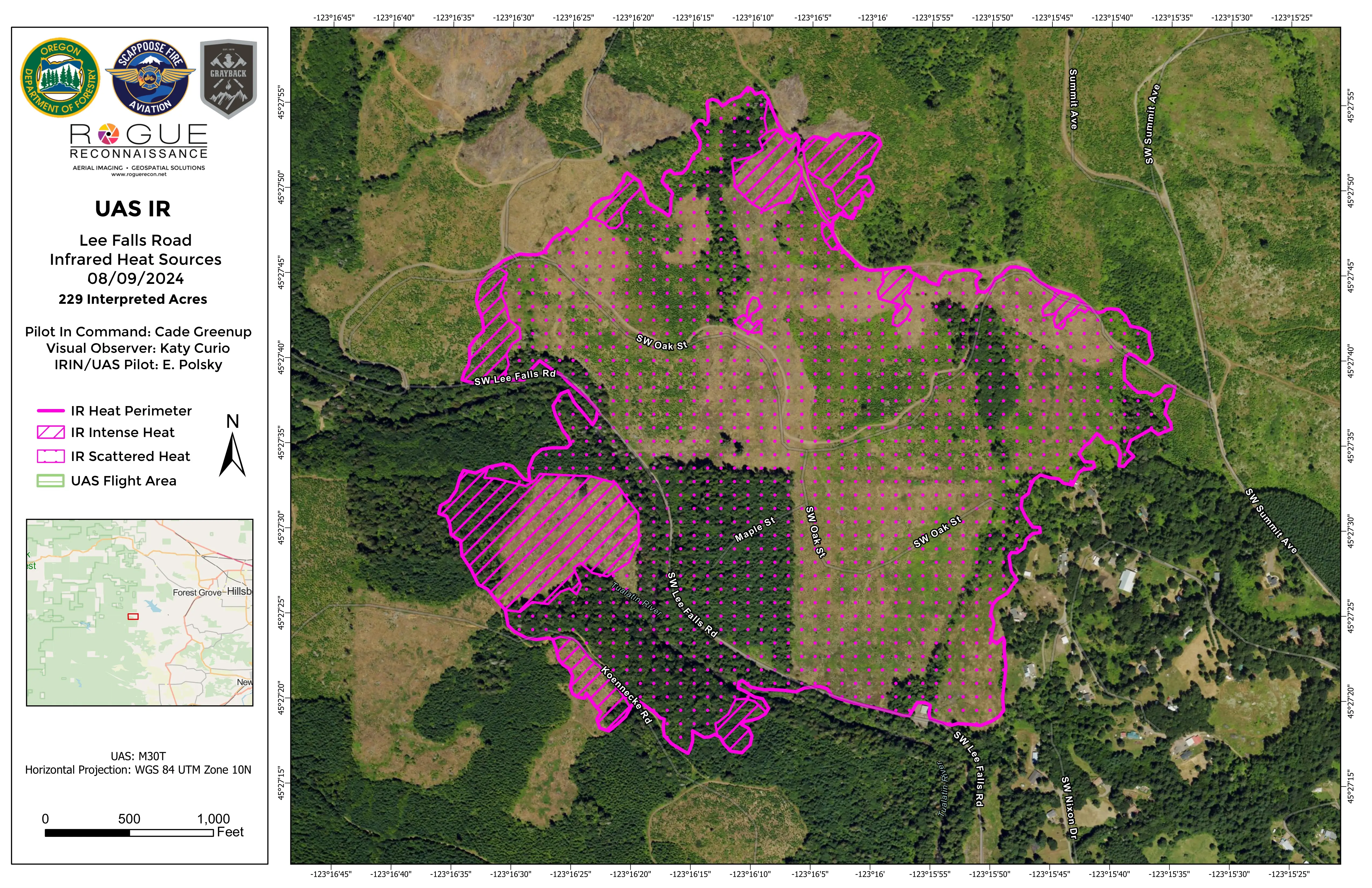
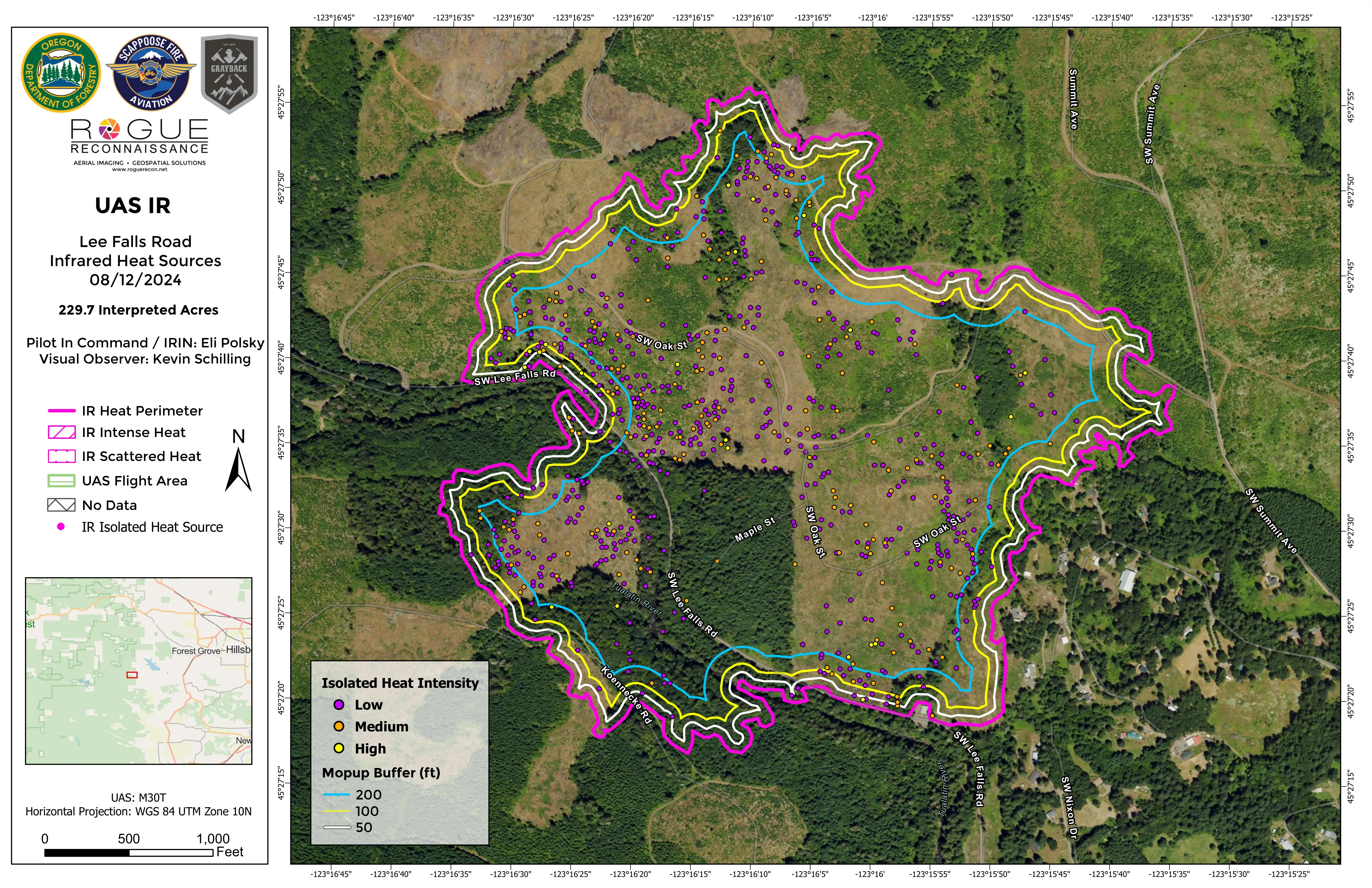
Lee Falls Road
9 deliverables
Five nights of heat intensity orthos and topos across an evolving perimeter. Templated for the receiving IMT, delivered the same hour the data came in.
-
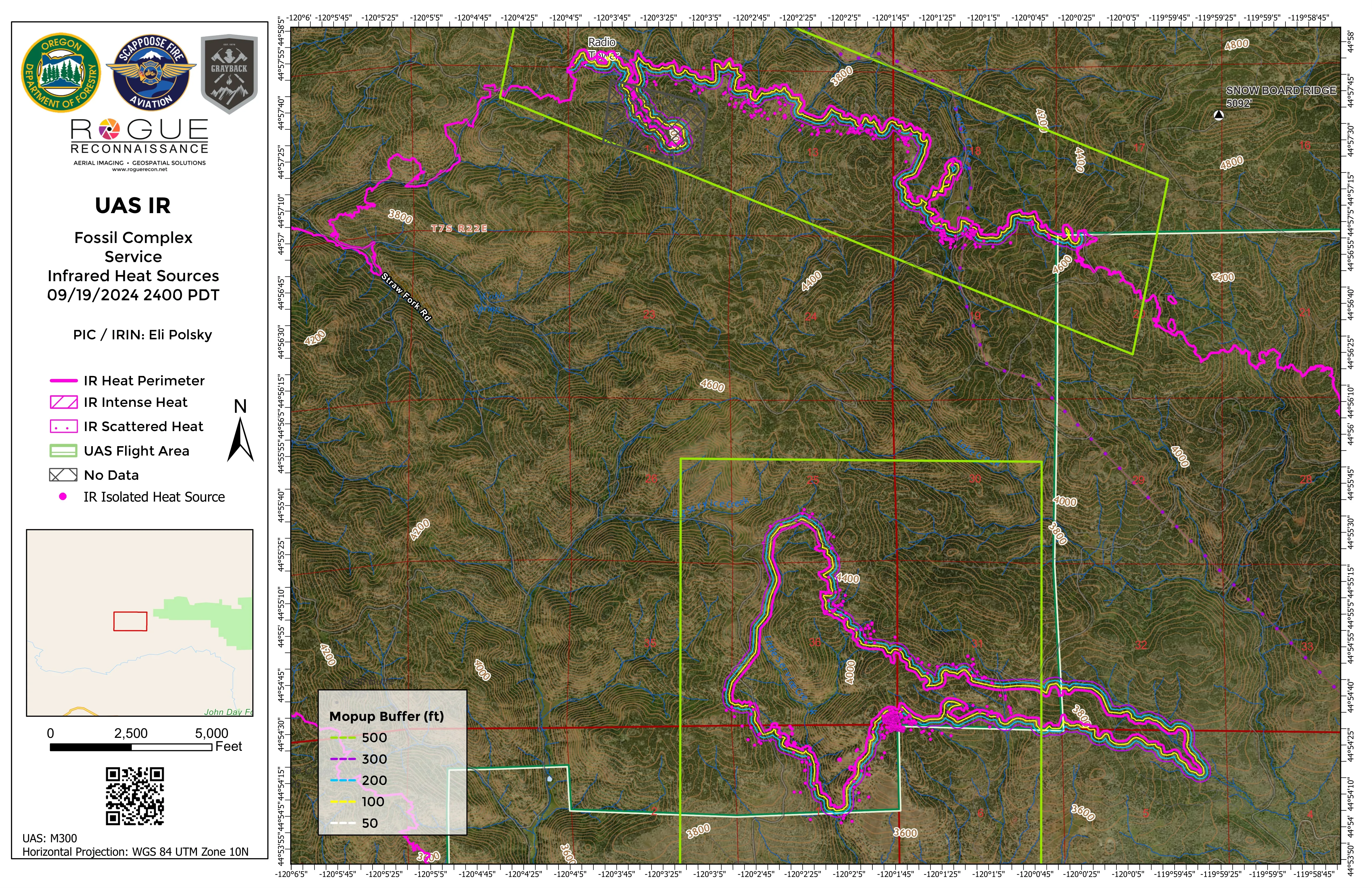
Service Fire
14 deliverables
Multi-division coverage across five night flights, including the Donut Div J heat structure. The pipeline kept pace with a perimeter that moved every shift.
-
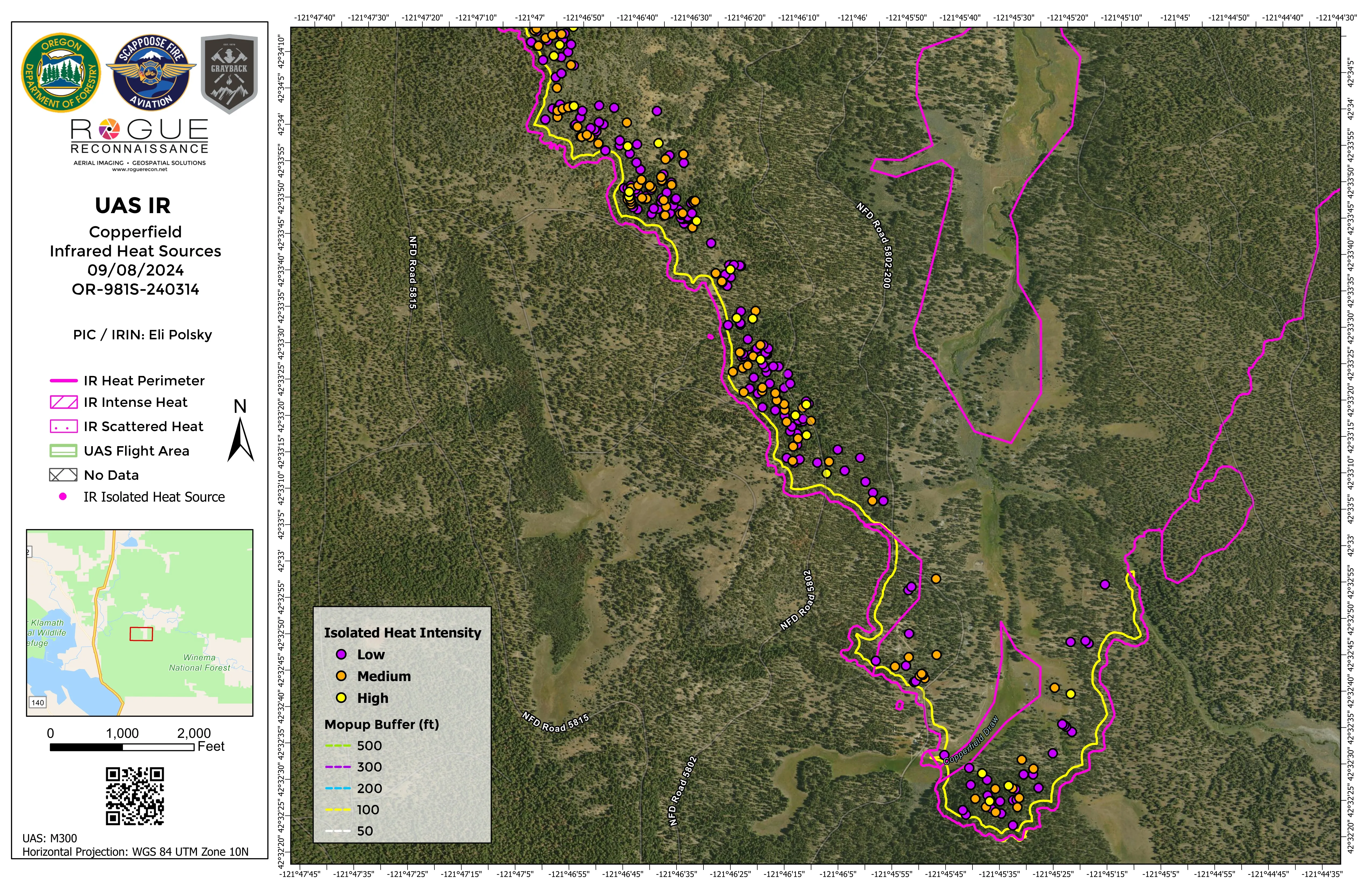
Copperfield
4 deliverables
Divisions A and F mapped on a single night flight. Ortho and topo paired so GIS teams and ground resources both got what they needed.
-
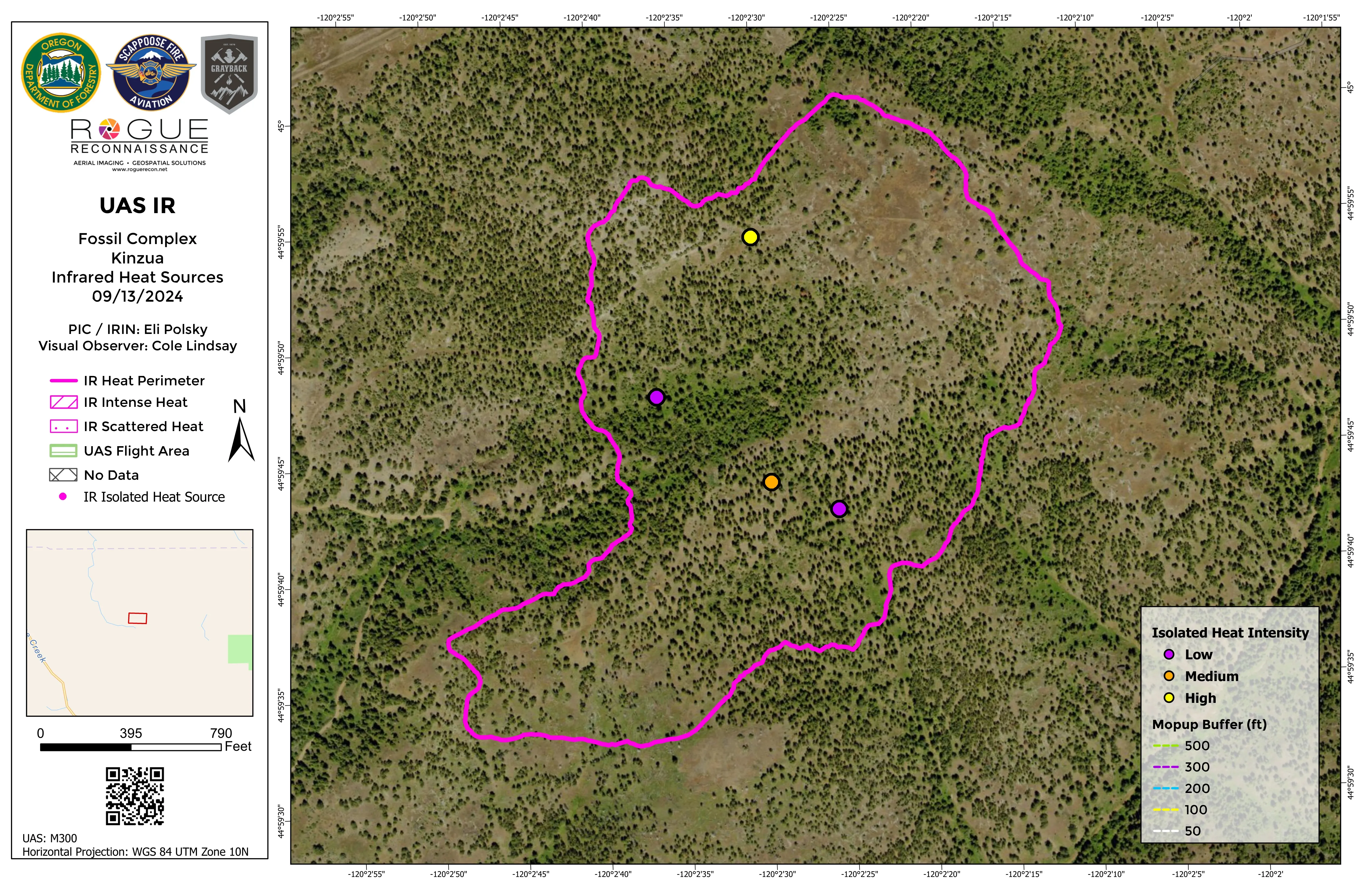
Kinzua
1 deliverable
A pre-dawn IR sweep delivered as a templated heat intensity ortho. Small footprint, full pipeline.
-
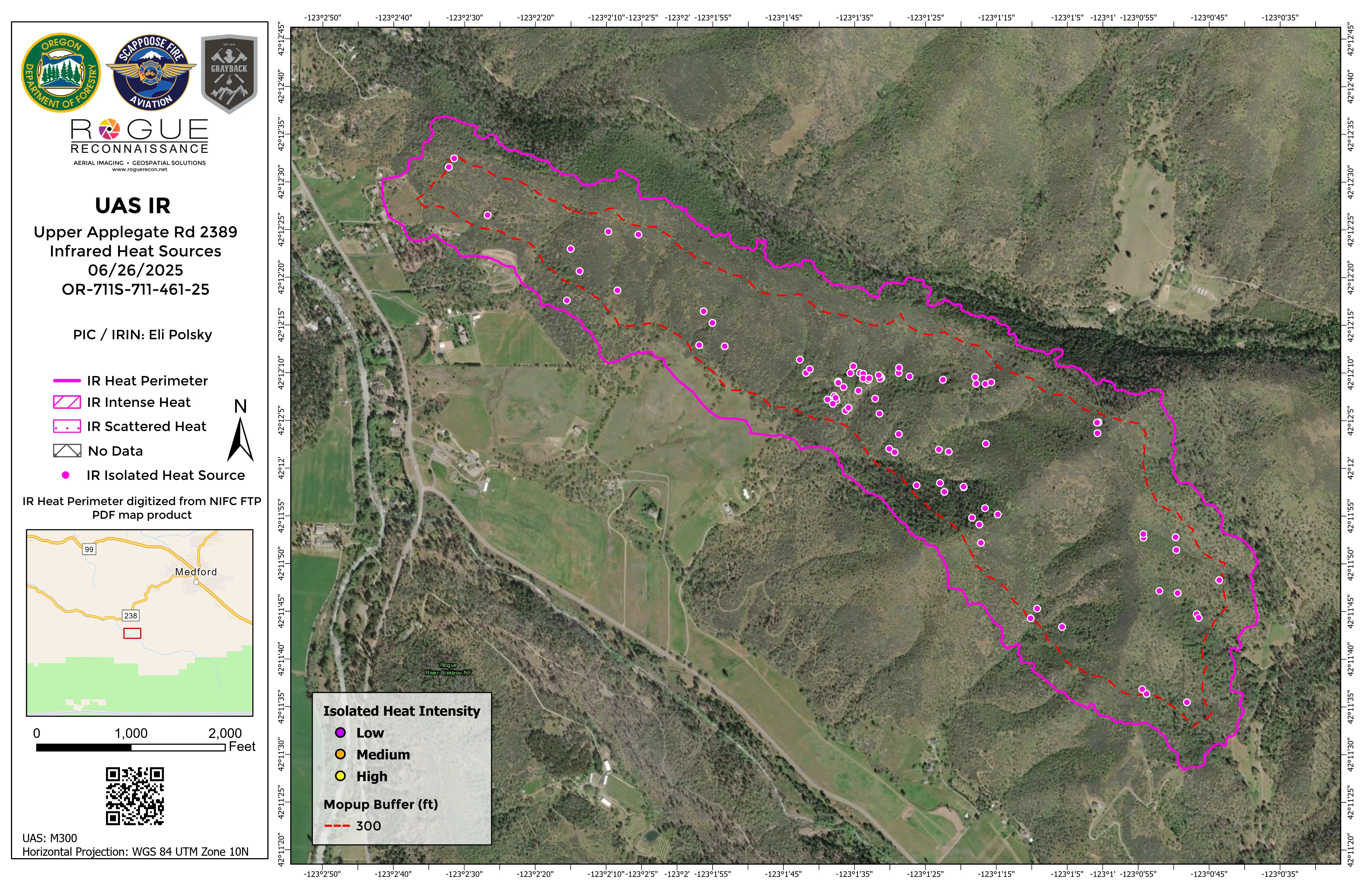
Upper Applegate Road
2 deliverables
Ignition operations support during prescribed work. IR ortho and topo paired for crews planning around the burn unit.
-
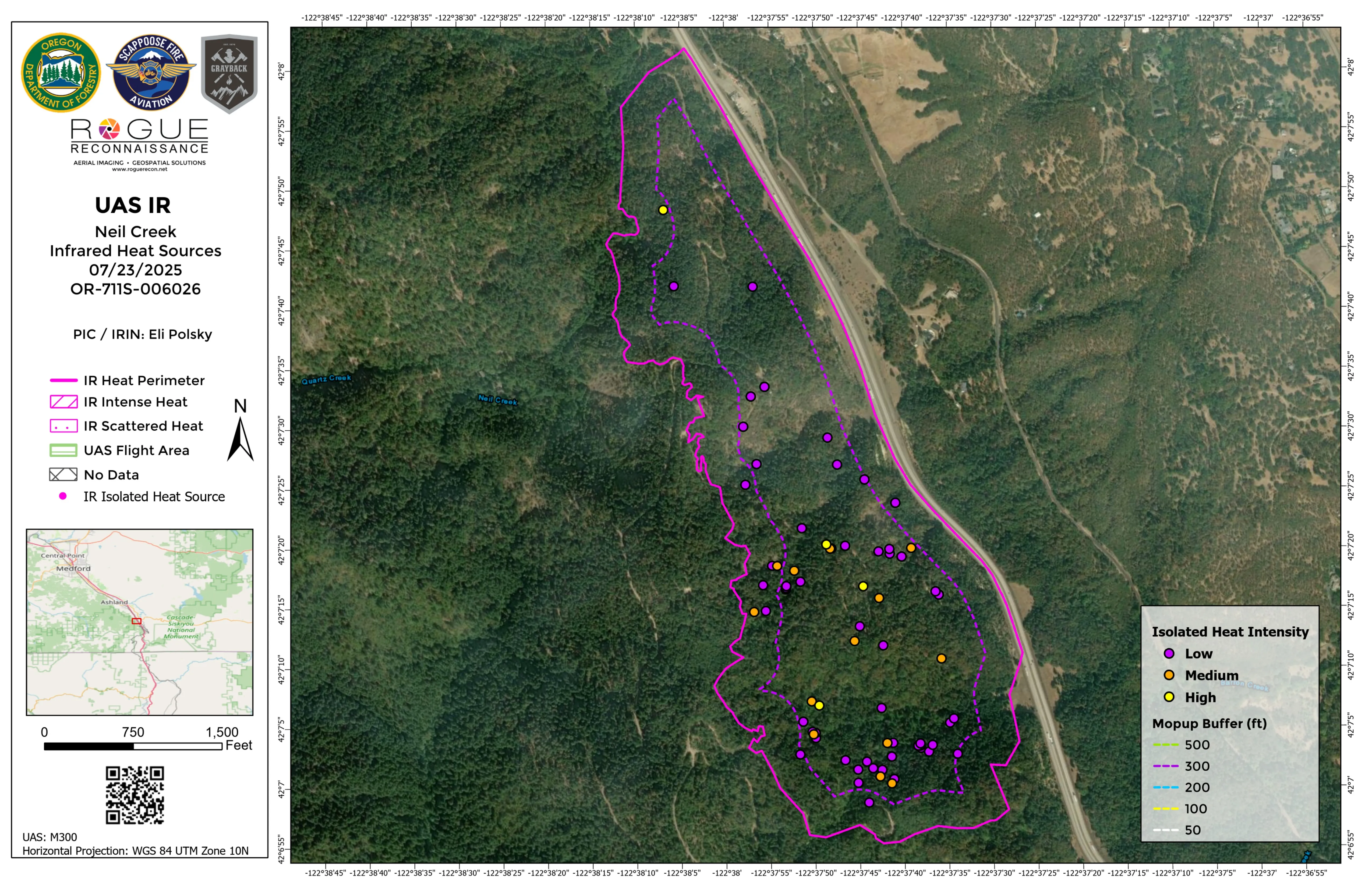
Grizzly Complex / Neil Creek
2 deliverables
Heat intensity coverage on the Neil Creek division of the Grizzly Complex. Templated, branded, into the IMT's hands.
Built with the fire community
Built in Oregon, open to operators and agencies anywhere.
UASWFC is a collaborative. It brings wildland fire drone pilots together with state and federal agencies, fire districts, and forestry cooperators around one standard. Developed in operational use with the Oregon Department of Forestry since the 2024 fire season, with deliverables aligned to the standards used by federal, state, tribal, and local fire agencies nationwide.
UASWFC participated in the Oregon UAS Innovation Challenge, Cohort 3, received grant funding, and competed in an investor pitch challenge. Read the deck and the program details ›
ODF has deployed the UASWFC platform in support of real-world wildfire incidents in the State of Oregon. The system has demonstrated its ability to support the centralized collection, organization, and standardization of UAS data in a way that aligns with the needs of incident management and aviation coordination.
Board of Directors
The people accountable for the work.
-
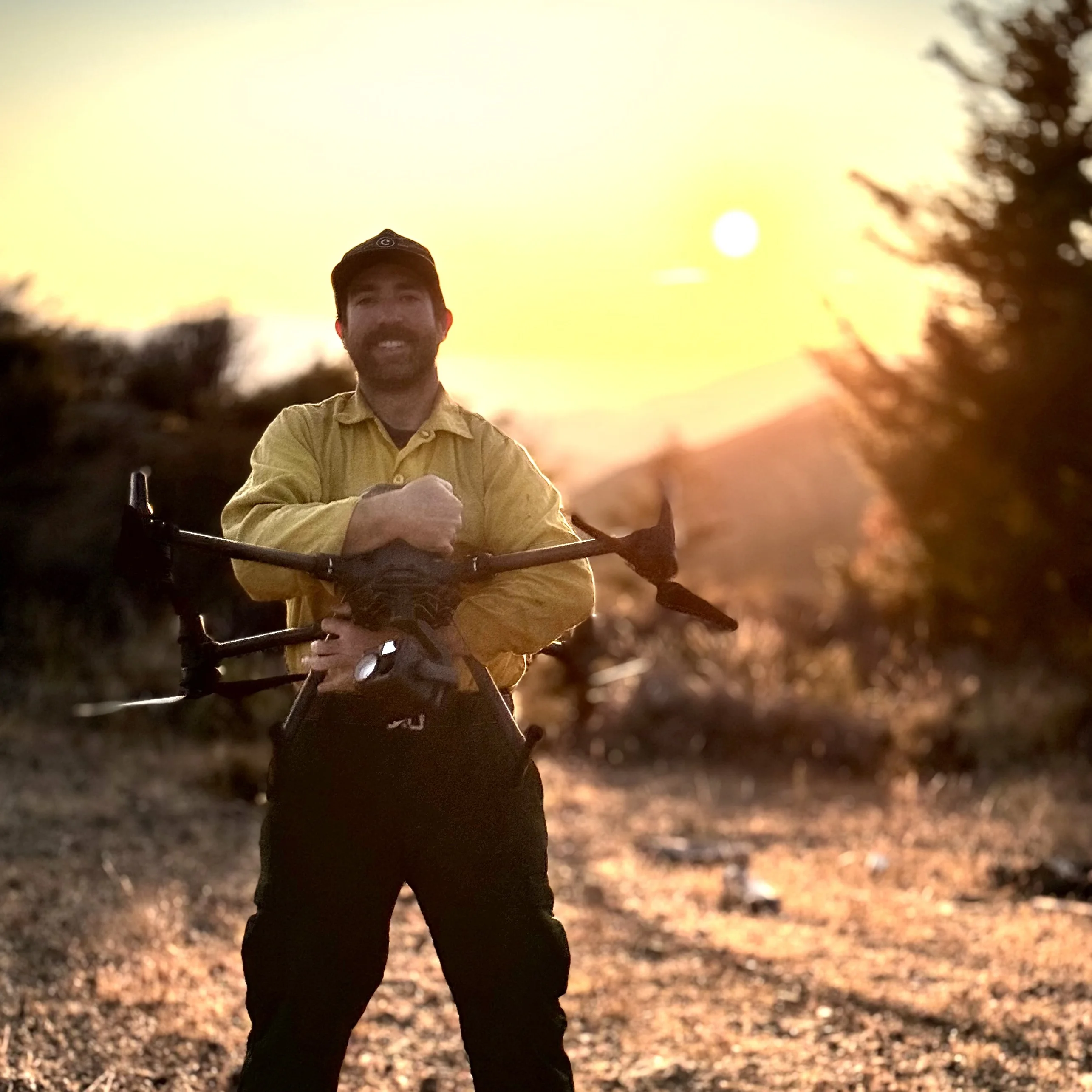
Eli Polsky
Founder · Executive Director
Wildland fire UAS operator since 2012. AD with US Forest Service. CWN resource with Oregon Department of Forestry.
-
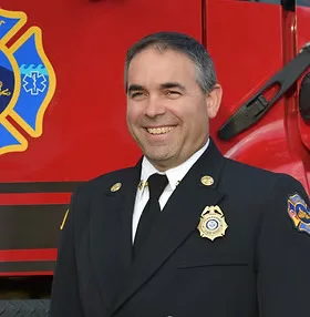
Jeff Pricher
Director
Fire Chief. Member, National Wildfire Coordinating Group UAS Subcommittee.
-

Nikki Hart-Brinkley
Director
GIS advisor and Esri affiliate. Technical authority on the geospatial standards behind every Collaborative deliverable.
Reach the Collaborative
Pilots, fire managers, supporters: one inbox.
If you are a UAS pilot interested in flying with the Collaborative, an incident commander or fire manager wanting our work on your next fire, or a supporter helping us reach more incidents, get in touch.